Project Description
The Magdalena-Eastbrook Evacuation Route Project in Los Altos Hills, California, provides an important route of egress route for a significant portion of the South-Eastern area of the Los Altos Hills Community in the event of a wildfire evacuation. To secure the integrity of this route, Los Altos Hills County Fire District and Santa Clara County FireSafe Council propose a roadside treatment of hazardous fuels.
You may read more about the project goals on the Santa Clara County FireSafe Council website.
Before & After Photos


Project Site
This project will treat 9 roads along the evacuation route. These include Eastbrook Avenue, Loyola Drive, Camino Hermoso Drive, Magdalena Road, Sunhills Drive, Kenbar Road, Rolly Road, Berkshire Drive, and Eloise Circle.
The north end of the project is located at the intersection of Magdalena Avenue and Eastbrook Avenue (37.3526530, -122.1078596) and the south end of the project is located at the intersection of Sunhills Drive and Mora Drive (37.3393474, -122.1009444).
This project will treat the following roads:
- Eastbrook Avenue: From Magdalena Avenue to Mora Drive. Approximately 1 linear miles, 2 treated miles.
- W Loyola Drive: From Eastbrook Avenue to Ravensbury Avenue. Approximately 0.9 linear miles, 1.8 treated miles.
- Camino Hermoso Drive: From Ravensbury Avenue to Magdalena Road. Approximately 0.2 linear miles, 0.4 treated miles.
- Magdalena Road: From Camino Hermoso Drive to Ravensbury Avenue. Approximately 1.3 linear miles, 2.6 treated miles.
- Sunhills Drive: From W Loyola Drive to Mora Drive. Approximately 0.2 linear miles, 0.4 treated miles.
- Kenbar Road: From Sunhills Drive to Rolly Drive. Approximately 0.1 linear miles, 0.2 treated miles.
- Rolly Road: From Kenbar Road to W Loyola Drive. Approximately 0.1 linear miles, 0.2 treated miles.
- Berkshire Drive: From W Loyola Drive to W Loyola Drive. Approximately 0.4 linear miles, 0.8 treated miles.
- Eloise Circle: From Berkshire Drive to W Loyola Drive. Approximately 0.2 linear miles, 0.4 treated miles.
Total treatment: 4.4 linear miles, 8.8 treated miles
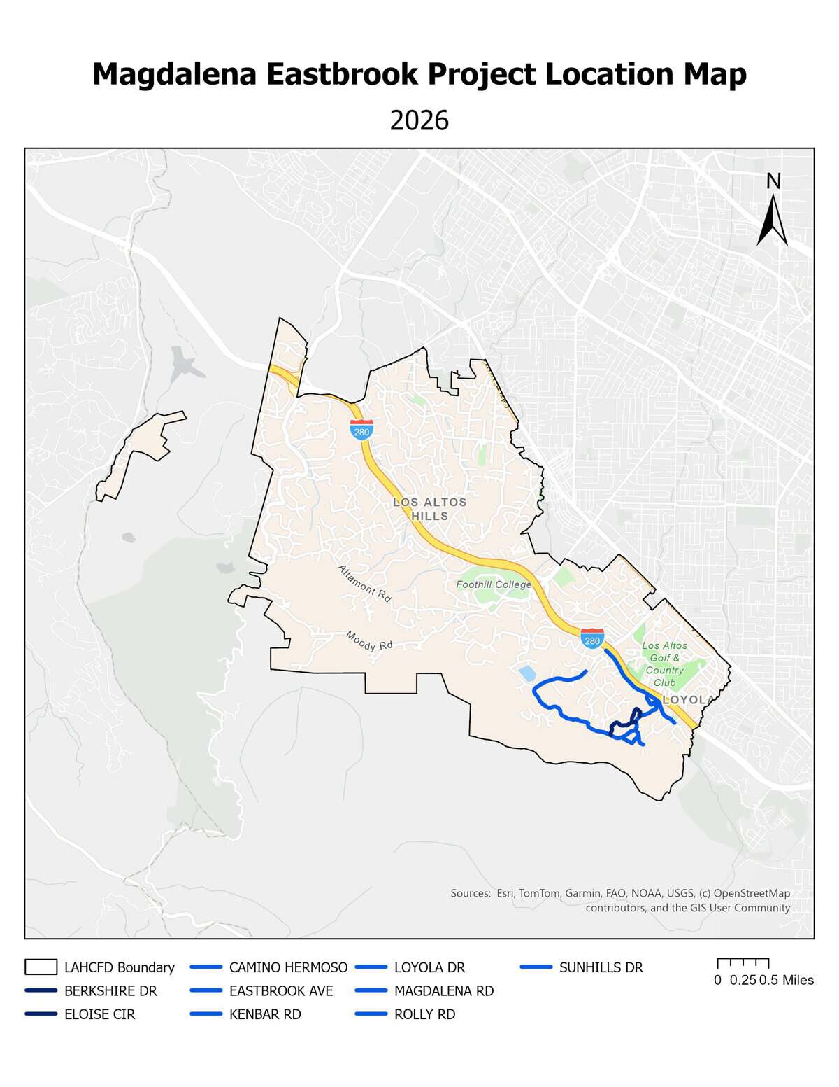
Click to enlarge.
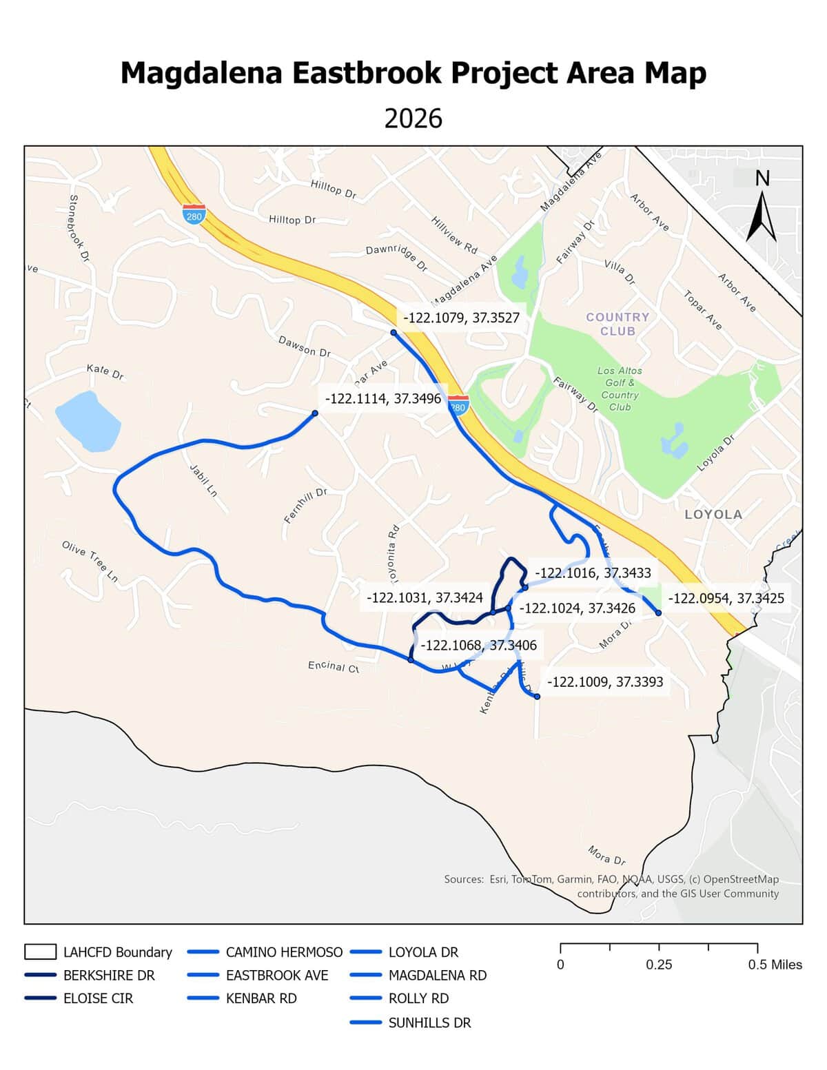
Click to enlarge.
Treatment History
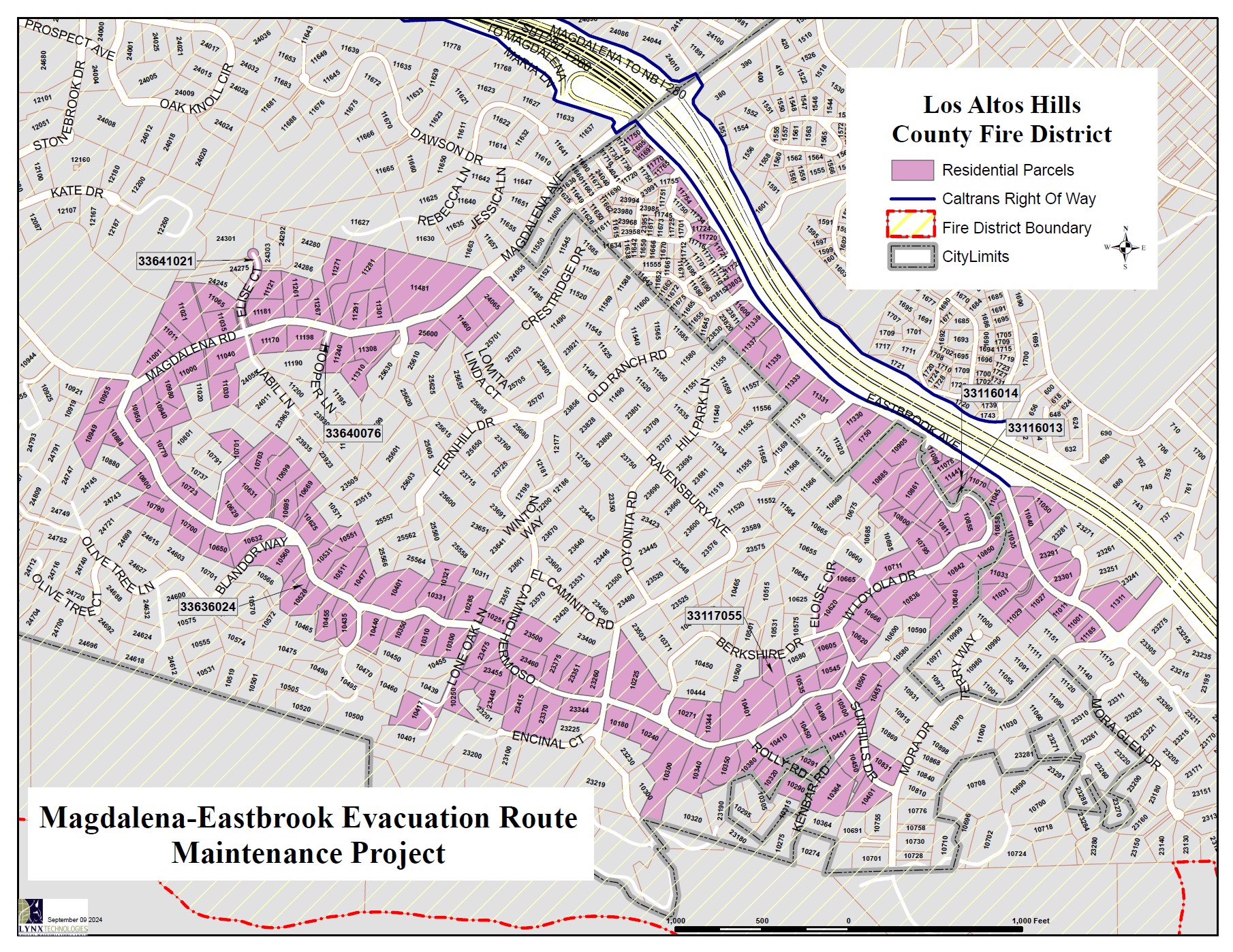
Click to enlarge.
2024 November Initial Treatment
The initial treatment of Magdalena – Eastbrook treated seven (7) roadways:
- Magdalena Avenue from Ravensbury Avenue to Camino Hermoso Drive
- Camino Hermoso Drive from Magdalena Avenue to West Loyola Drive
- West Loyola Drive from Camino Hermoso Drive to Eastbrook Avenue
- Rolly Road from West Loyola Drive to Kenbar Road
- Kenbar Road from Rolly Road to Sunhills Drive
- Sunhills Drive from Mora Drive to W. Loyola Drive
- Eastbrook Avenue from Mora Drive to Magdalena Avenue
Project length: approximately 7.5 treated miles
Click to enlarge.
2026 October Maintenance Treatment
The maintenance treatment of Magdalena – Eastbrook will add two (2) tributary roads to the project scope and treat a total of nine (9) roadways:
- Magdalena Avenue from Ravensbury Avenue to Camino Hermoso Drive
- Camino Hermoso Drive from Magdalena Avenue to West Loyola Drive
- West Loyola Drive from Camino Hermoso Drive to Eastbrook Avenue
- Rolly Road from West Loyola Drive to Kenbar Road
- Kenbar Road from Rolly Road to Sunhills Drive
- Sunhills Drive from Mora Drive to W. Loyola Drive
- Eastbrook Avenue from Mora Drive to Magdalena Avenue
- Berkshire Drive from W. Loyola Drive to W. Loyola Drive
- Eloise Circle from Berkshire Drive to W. Loyola Drive
Project length: approximately 8.8 treated miles
