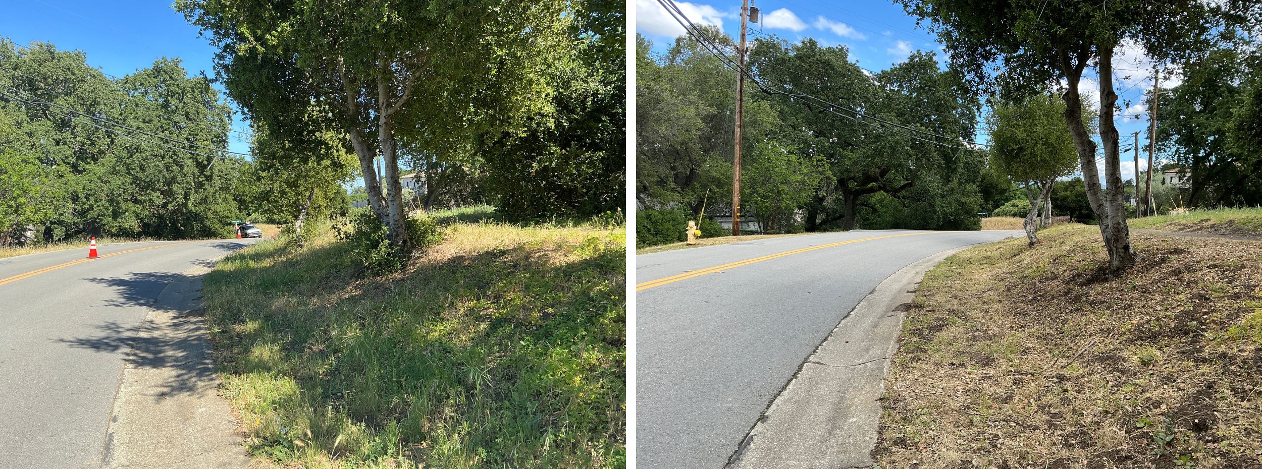
Before and after photos showing roadside vegetation treatment on Black Mountain Road. Low-growing tree branches and excess vegetation are cut away from the lower portion of the trees to create a separation between the tree canopy and ground fuels. Weeds, grasses and ground vegetation within the public right of way are trimmed to shorter than 6″. When there’s a path, as shown here, the easement allows for trimming and additional 1 foot on each side of the path.
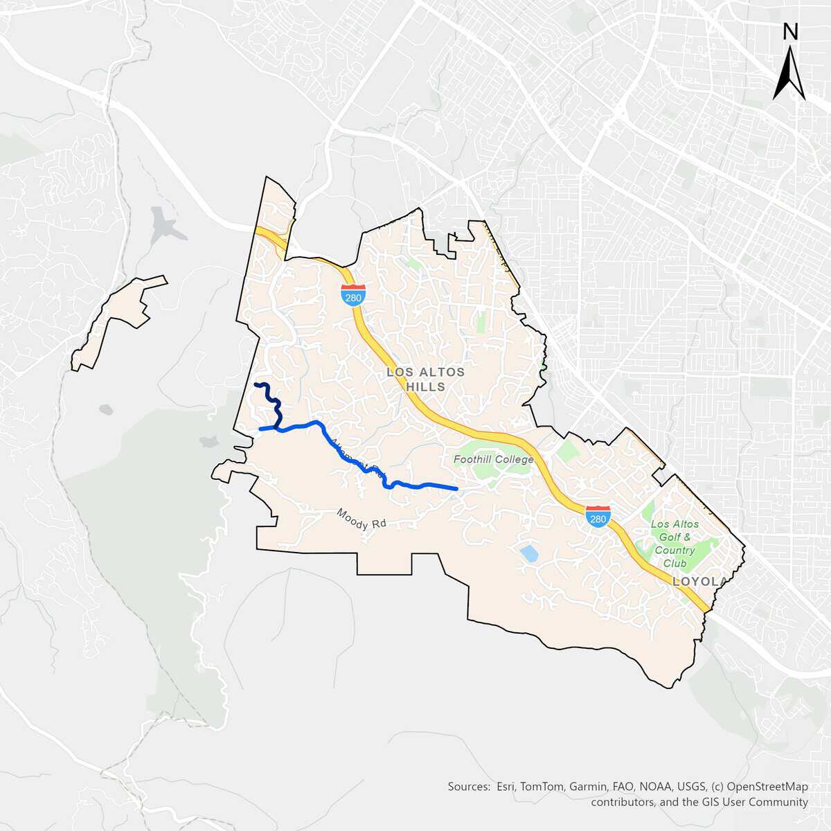
Altamont Evacuation Route Project
The Altamont Evacuation Route Project treats Altamont Road.
- 2022 May – Initial Treatment
- 2024 September – Maintenance Treatment
- 2026 June – Maintenance Treatment and addition of tributary roads
Click to enlarge.
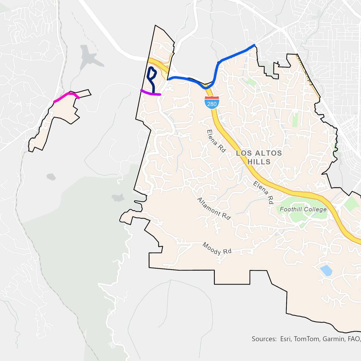
Arastradero Evacuation Route Project
The Arastradero Evacuation Route Project treats Arastradero Road.
- 2022 December – Initial Treatment
- 2024 October – Maintenance Treatment
- 2026 September – Maintenance Treatment and addition of tributary roads
Click to enlarge.
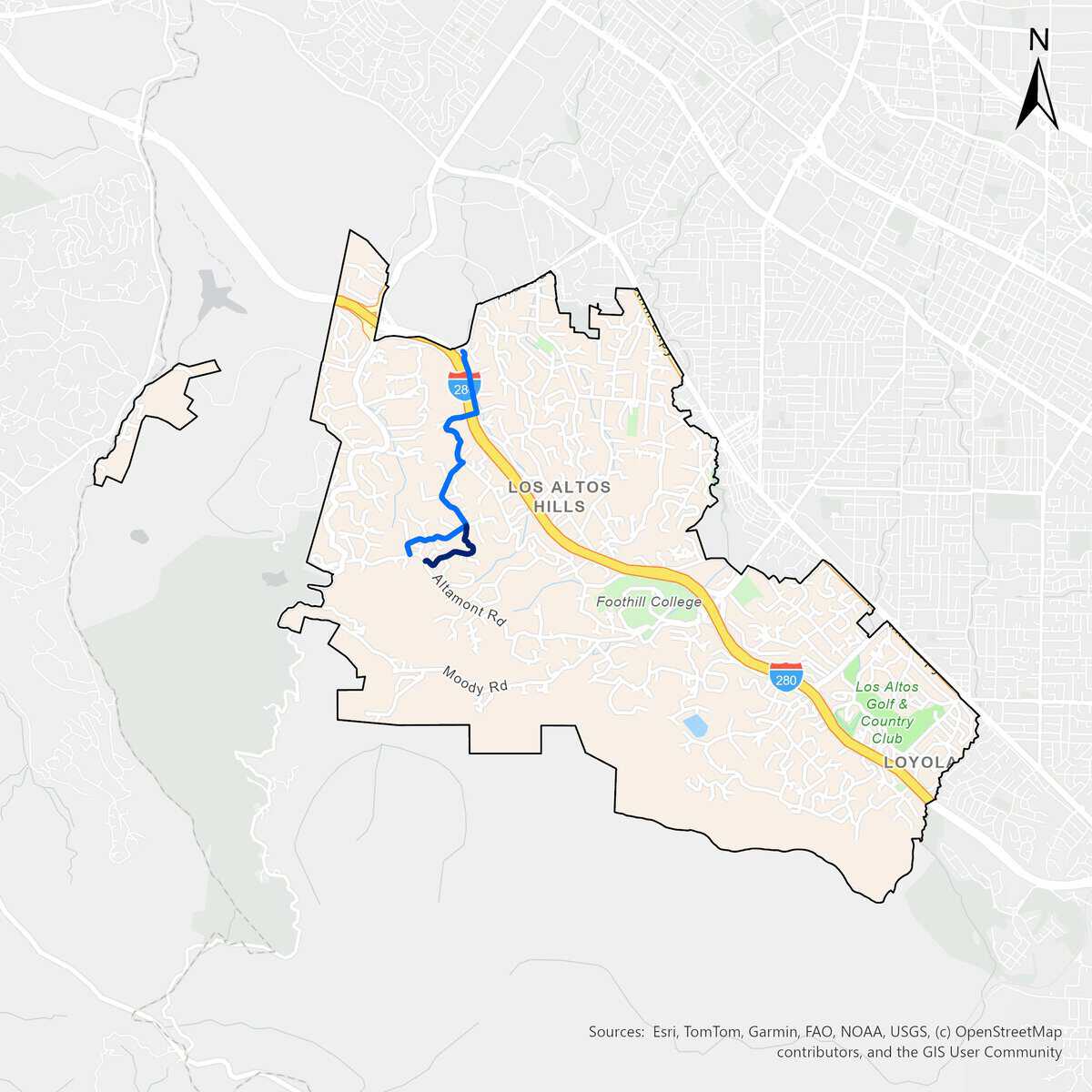
Black Mountain – Purissima Evacuation Route Project
The Black Mountain – Purissima Evacuation Route Project treats Black Mountain Road, Natoma Road, Elena Road, and Purissima Road.
- 2024 March – Initial Treatment
- 2026 April – Maintenance Treatment
Click to enlarge.
Elena – Fremont Evacuation Route Project
The Elena – Fremont Evacuation Route Project treats Elena Road, La Barranca Road, Purissima Road, Concepcion Road, W. Fremont Road, Westwind Way, La Paloma Road, Manuella Road, Manuella Avenue, Estacada Drive, and Miranda Road.
- 2024 May – Initial Treatment of Elena Road, La Barranca Road, Concepcion Road, and Fremont Road
- 2024 June – Initial Treatment of Purissima Road, La Paloma Road, and Westwind Way
- 2026 May – Maintenance Treatment of combined routes and addition of tributary roads
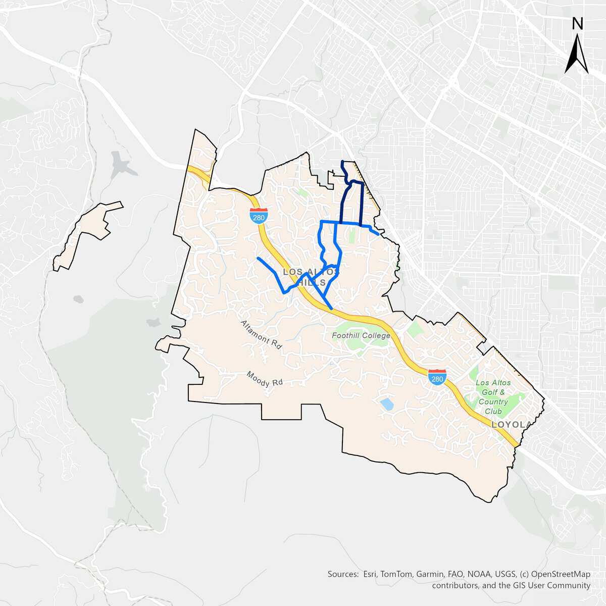
Click to enlarge.
Elena-Taaffe Evacuation Route Project
The Elena – Taaffe Evacuation Route Project treats Taaffe Road and Elena Road.
- 2025 August – Initial Treatment
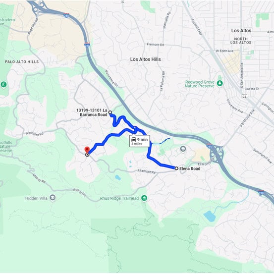
Click to enlarge.
Magdalena – Eastbrook Evacuation Route Project
The Magdalena – Eastbrook Evacuation Route Project treats portions of Magdalena Avenue, Camino Hermoso Drive, West Loyola Drive, Rolly Road, Kenbar Road, Sunhills Drive, and Eastbrook Avenue.
- 2024 November – Initial Treatment
- 2026 October – Maintenance Treatment and addition of tributary roads
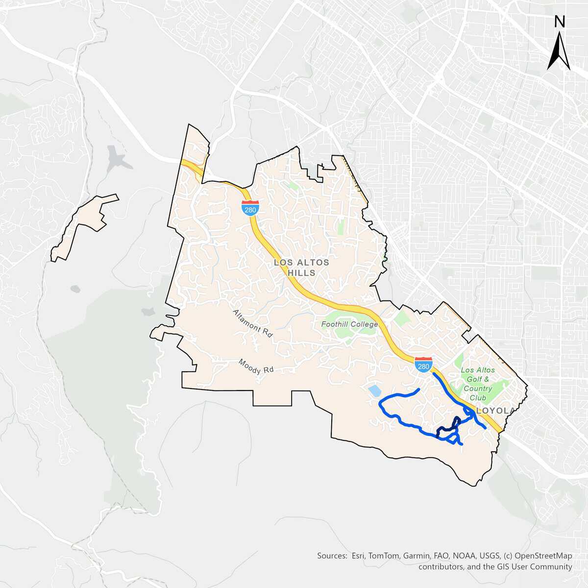
Click to enlarge.
Mora – Summerhill Evacuation Route Project
The Mora – Summerhill Evacuation Route Project treats Ravensbury Avenue, Magdalena Avenue, Summerhill Avenue, and Mora Drive.
- 2023 August – Initial Treatment of Mora Drive and Ravensbury Avenue
- 2023 October – Initial Treatment of Magdalena Avenue and Summerhill Avenue
- 2025 October – Maintenance Treatment of combined routes
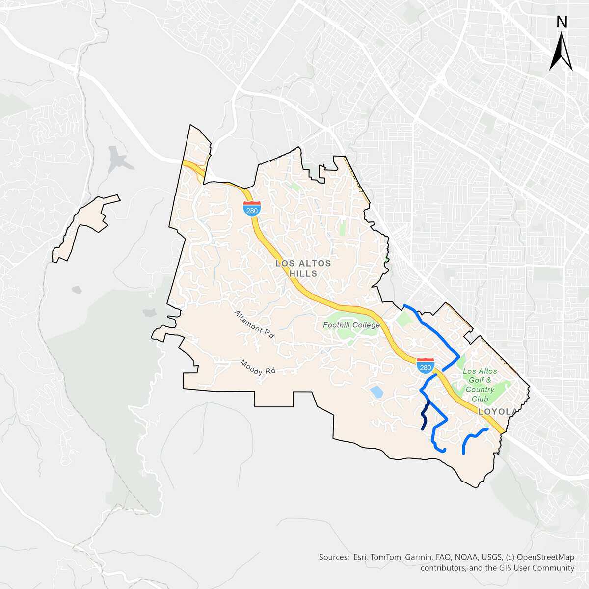
Click to enlarge.
Page Mill Evacuation Route Project
The Page Mill Evacuation Route Project treats the entirety of Page Mill Road within the Los Altos Hills County Fire District boundary, from Berry Hill Lane to 26443 Page Mill Road on the West side and to 10920 Page Mill Road on the East side.
- 2020 June – Initial Treatment Phase 1 (southern portion)
- 2021 January – Initial Treatment Phase II (northern portion)
- 2023 June – Maintenance Treatment
- 2025 May – Maintenance Treatment

Click to enlarge.
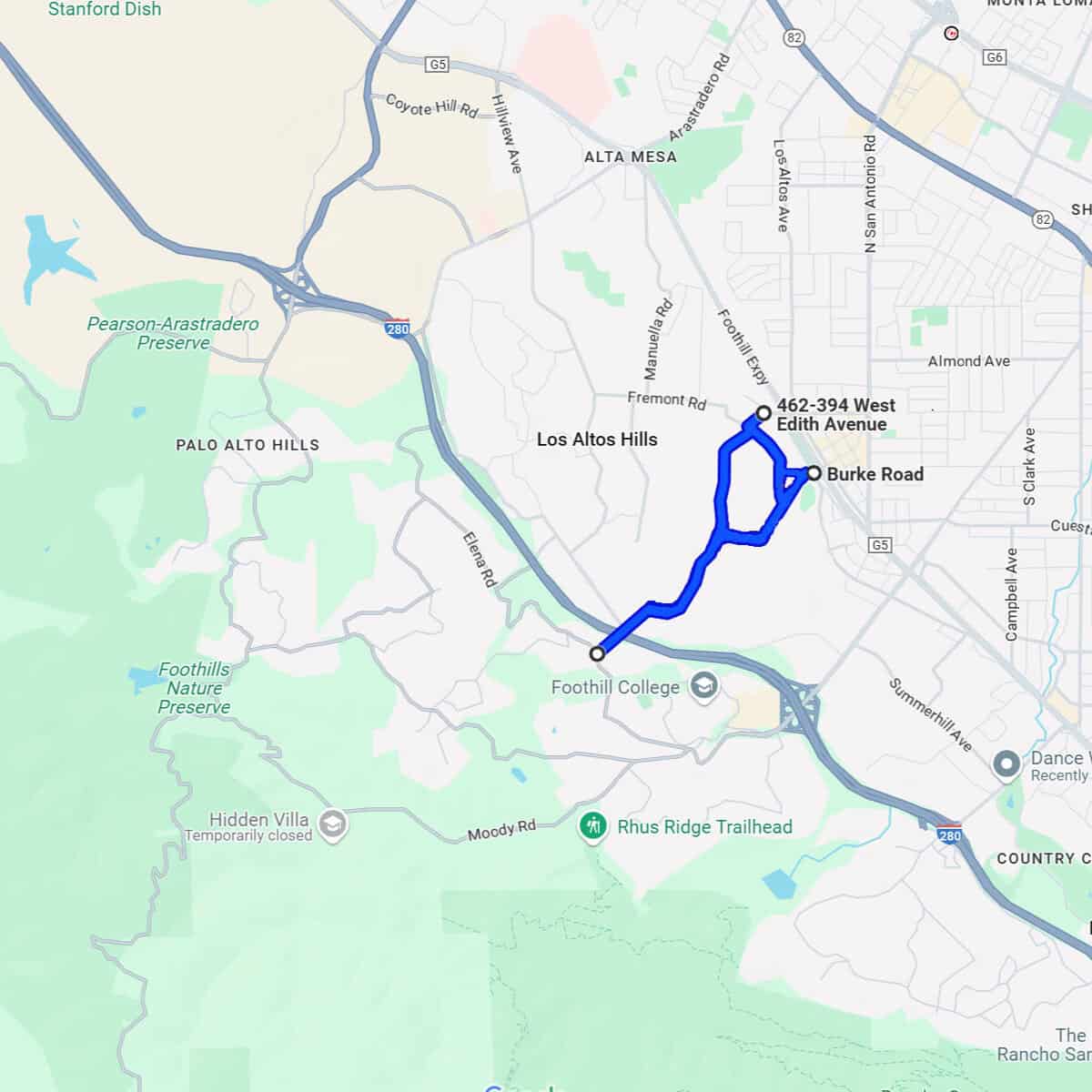
Robleda – Burke Evacuation Route Project
The Robleda – Burke Evacuation Route Project treats Robleda Road, Chapin Road, Fremont Road, W. Edith Avenue, Burke Road, and Old Altos Road.
- 2023 November – Initial Treatment
- 2025 November – Maintenance Treatment
Click to enlarge.

Before and after photos showing roadside treatment at the Moody – El Monte – I-280 Interchange. Low-growing tree branches and excess vegetation are cut away from the lower portion of the trees to create a separation between the tree canopy and ground fuels.
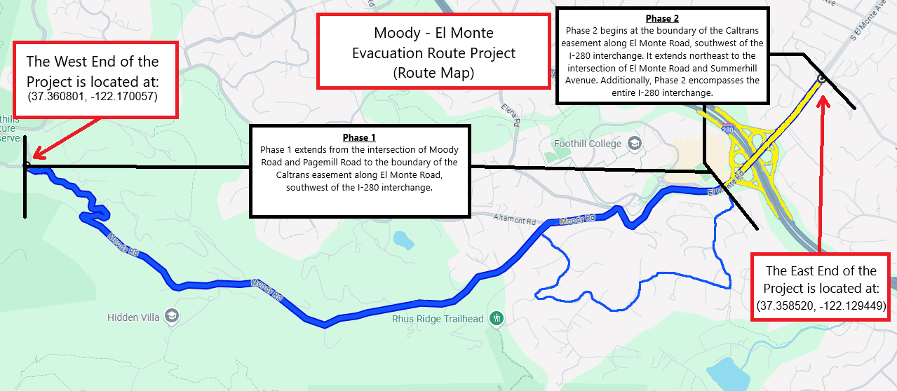
Moody – El Monte Evacuation Route and El – Monte – I-280 Interchange Project
The Moody – El Monte Evacuation Route Project treats Moody Road, Tepa Way, Summit Wood Road, La Loma Drive, Prospect Avenue, Stonebrook Drive, El Monte Road, and the I280 – El Monte Road Cloverleaf/Interchange.
- 2021 November – Initial Treatment
- 2025 June – Maintenance Treatment
Click to enlarge.
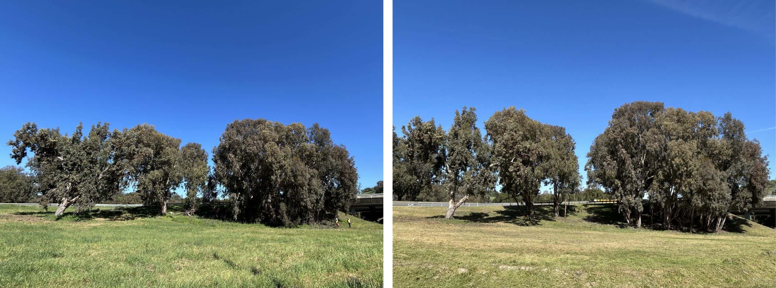
Before and after photos showing roadside treatment at the Page Mill – I-280 Interchange. Low-growing tree branches and excess vegetation are cut away from the lower portion of the trees to create a separation between the tree canopy and ground fuels. Weeds, grasses and ground vegetation within the public right of way are trimmed to shorter than 6″.
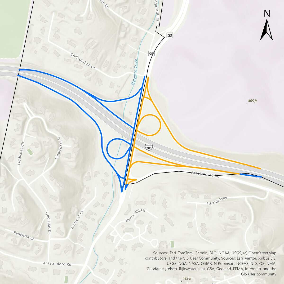
Page Mill – I-280 Interchange Project
The Page Mill – I-280 Interchange Treatment Project treats the four outer ramps and two inner loop ramps of the Page Mill Road – Interstate Highway 280 interchange in collaboration with Palo Alto.
- 2026 March – Initial Treatment
Click to enlarge.
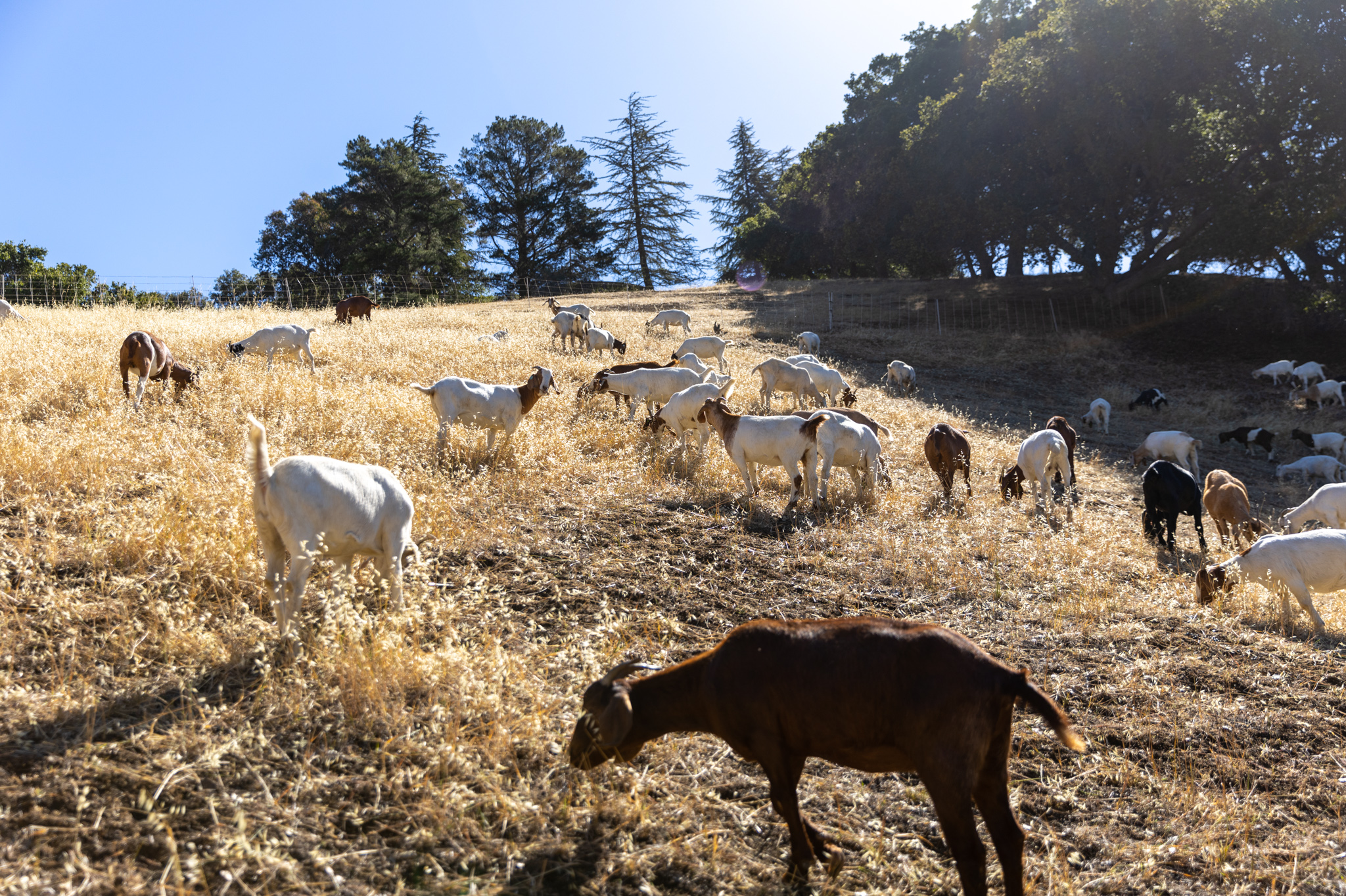
Goats grazing at Byrne Preserve
Goat Grazing at Byrne Preserve
The LAHCFD uses goats as an alternative form of vegetation mitigation and fire fuel management in the difficult-to-reach terrain of Byrne Open Space Preserve. The arrival of the goats (usually around May) is a tradition that marks the bucolic arrival of spring in the Hills. The goats graze on grass, low-hanging branches, brush, and flashy fire fuels of Byrne Preserve.
