Los Altos Hills County Fire District

  • About
    • District Overview
    • Map of the District
    • District Services Guide
  • Programs
    • Home Ignition Zone (HIZ) Assessment and Rebate Program
    • Defensible Space Brush Chipping and Removal
    • Firewise USA®
    • Monthly Brush Drop Off Program
    • Community Emergency Response Team (CERT)
      • CERT Calendar
    • Weed Abatement
    • Vegetation Management
  • Projects
    • Frequently Asked Questions (FAQs)
    • Current and Upcoming Projects
      • Arastradero Evacuation Route Project
      • Magdalena-Eastbrook Evacuation Route Project
      • Magdalena / I-280 Interchange Project
      • I-280 Project
    • Projects Archive
  • Community Outreach
    • Preparing for Emergencies
      • Red Flag Warnings
      • Fire Extinguishers
      • LAH Resident “OK” Card
      • Youth Preparedness
    • Take A Class
      • 2026 Preparedness Calendar
      • 2025 Preparedness Guide
      • 2024 Preparedness Guide
    • Request a Presentation
  • Governance
    • Commission Overview
    • Meetings
    • Strategic Plan
    • Chart of Services
    • CWPP / Annex 4 / Addendum
    • Finances
    • Find Public Documents
  • Meetings
  • Contact Us
    • Contact Us
Home » Community Projects » Arastradero Evacuation Route Project

Arastradero Evacuation Route Project

Project Updates

Maintenance treatment was completed on Friday, September 11, 2026.

Project Description

The Arastradero evacuation route in Los Altos Hills, California provides a significant route of egress/ingress for the northern portion of the Los Altos Hills community in the event of a fire. To secure the integrity of this egress/ingress route, Los Altos Hills County Fire District and Santa Clara County FireSafe Council propose a roadside treatment of hazardous fuels.

You may read more about the Arastradero project goals on the Santa Clara County FireSafe Council website.

Read the Arastradero media release.


How to Participate in a Project Near You

  • Meet with a team member to discuss specific work on your property
  • Complete and return the Right of Entry (ROE) permit
  • Coordinate your work to remove hazardous vegetation on your parcel with the schedule of the evacuation route project in your area (sign up for our Defensible Space Brush Chipping and Removal Program)

Complete the Right of Entry (ROE) permit on the Santa Clara County FireSafe Council website

Before & After Photos

Mobile users: For the best experience, please rotate your phone to landscape mode.
arastradero-maintenance-before-after-set-1
Altamont evac route project

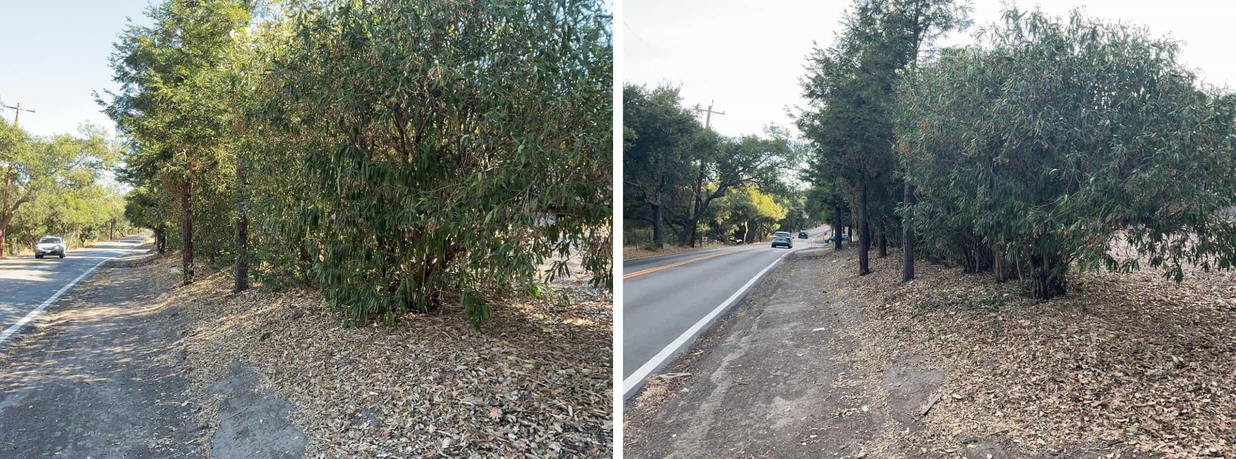
Low-growing tree branches and excess vegetation are cut away from the lower portion of the trees to create a separation between the tree canopy and ground fuels. When there's a path, as shown here, the easement allows for trimming and additional 1 foot on each side of the path.
arastradero-maintenance-before-after-set-2
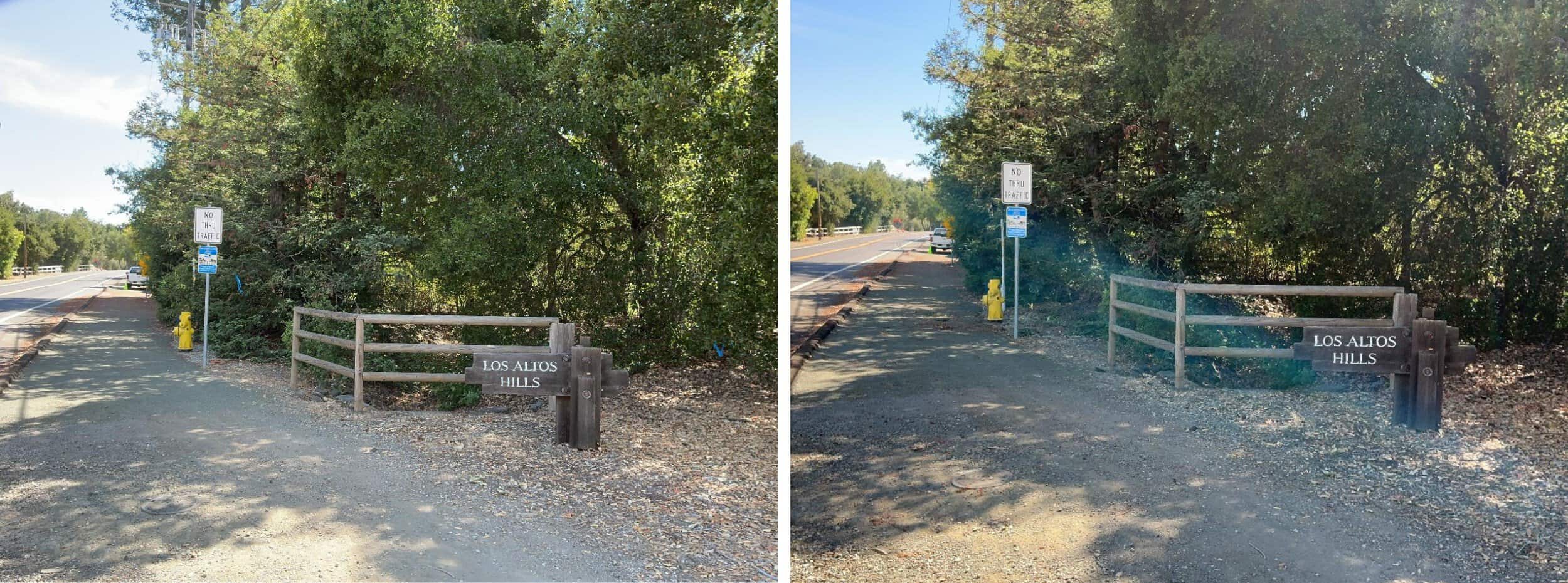
Vegetation will be cleared within a 3 foot bubble around fire hydrants to allow for proper identification and use of these assets by emergency service personnel.

Vegetation will be cleared within a 3 foot bubble around fire hydrants to allow for proper identification and use of these assets by emergency service personnel.

arastradero-maintenance-before-after-set-3
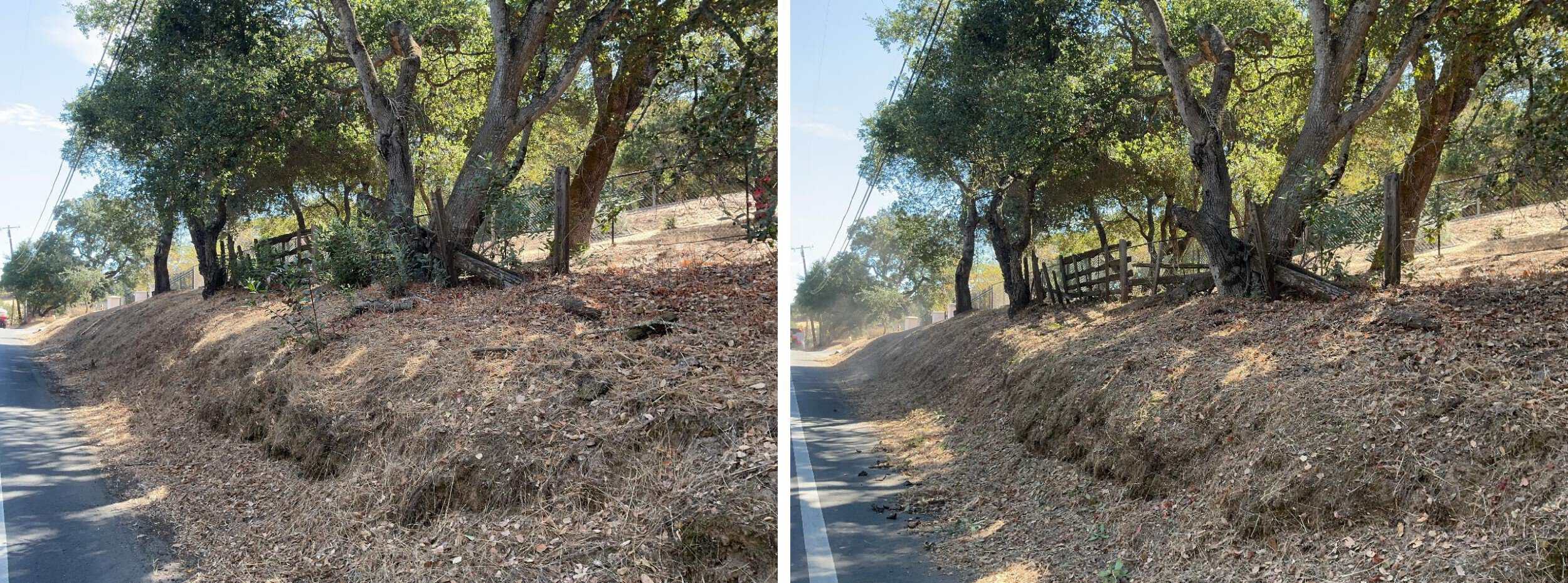
Hazardous vegetation, including brush, grasses, and tree limbs, is cleared to the fence line.

Hazardous vegetation, including brush, grasses, and tree limbs, is cleared to the fence line.

arastradero-maintenance-before-after-set-4
Low-growing tree branches and excess vegetation are cut away from the lower portion of the trees to create a separation between the tree canopy and ground fuels. Weeds, grasses and ground vegetation within the public right of way are trimmed to shorter than 6". When there's a path, as shown here, the easement allows for trimming and additional 1 foot on each side of the path.
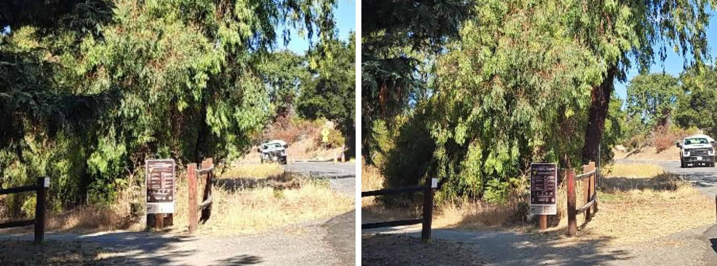
Low-growing tree branches and excess vegetation are cut away from the lower portion of the trees to create a separation between the tree canopy and ground fuels. Weeds, grasses and ground vegetation within the public right of way are trimmed to shorter than 6". When there's a path, as shown here, the easement allows for trimming and additional 1 foot on each side of the path.
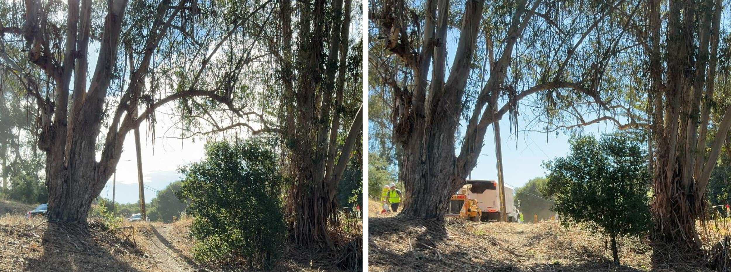
arastradero-maintenance-before-after-set-5
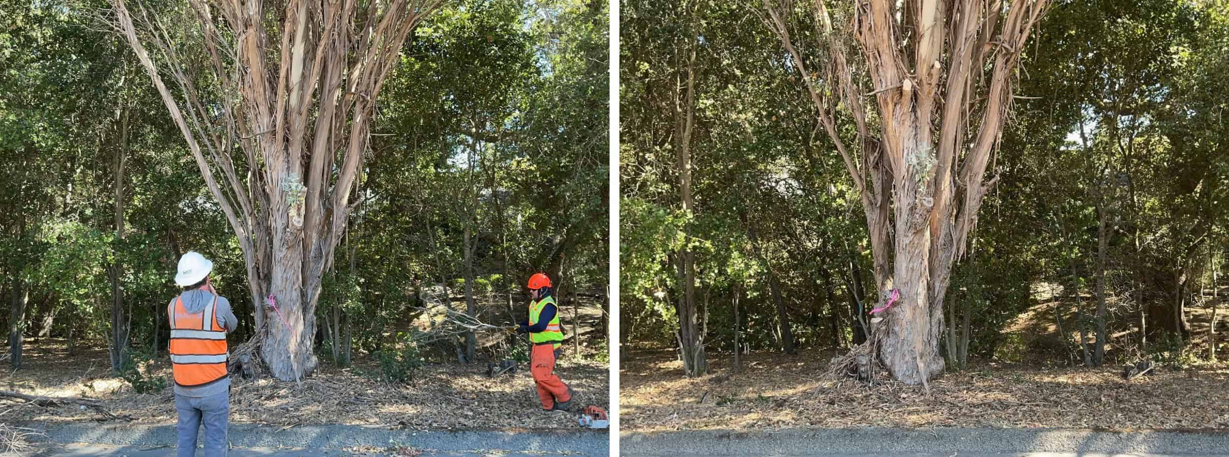
Low-growing tree branches and excess vegetation are cut away from the lower portion of the trees to create a separation between the tree canopy and ground fuels. Overgrown areas of vegetation will be thinned out. When there's a path, as shown here, the easement allows for trimming and additional 1 foot on each side of the path.
Low-growing tree branches and excess vegetation are cut away from the lower portion of the trees to create a separation between the tree canopy and ground fuels. Overgrown areas of vegetation will be thinned out. When there's a path, as shown here, the easement allows for trimming and additional 1 foot on each side of the path.
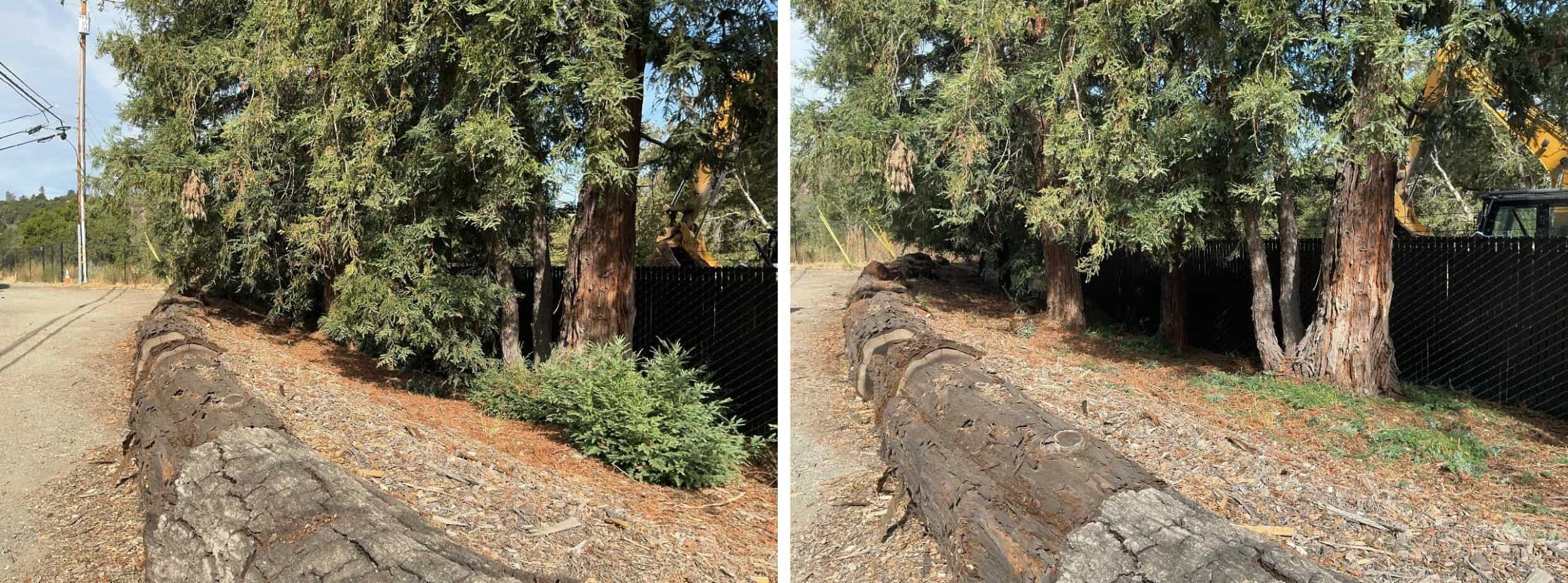
arastradero-maintenance-before-after-set-6
Low-growing tree branches and excess vegetation are cut away from the lower portion of the trees to create a separation between the tree canopy and ground fuels. Hazardous vegetation, including brush, grasses, and tree limbs, is cleared to the fence line.

Low-growing tree branches and excess vegetation are cut away from the lower portion of the trees to create a separation between the tree canopy and ground fuels. Hazardous vegetation, including brush, grasses, and tree limbs, is cleared to the fence line.

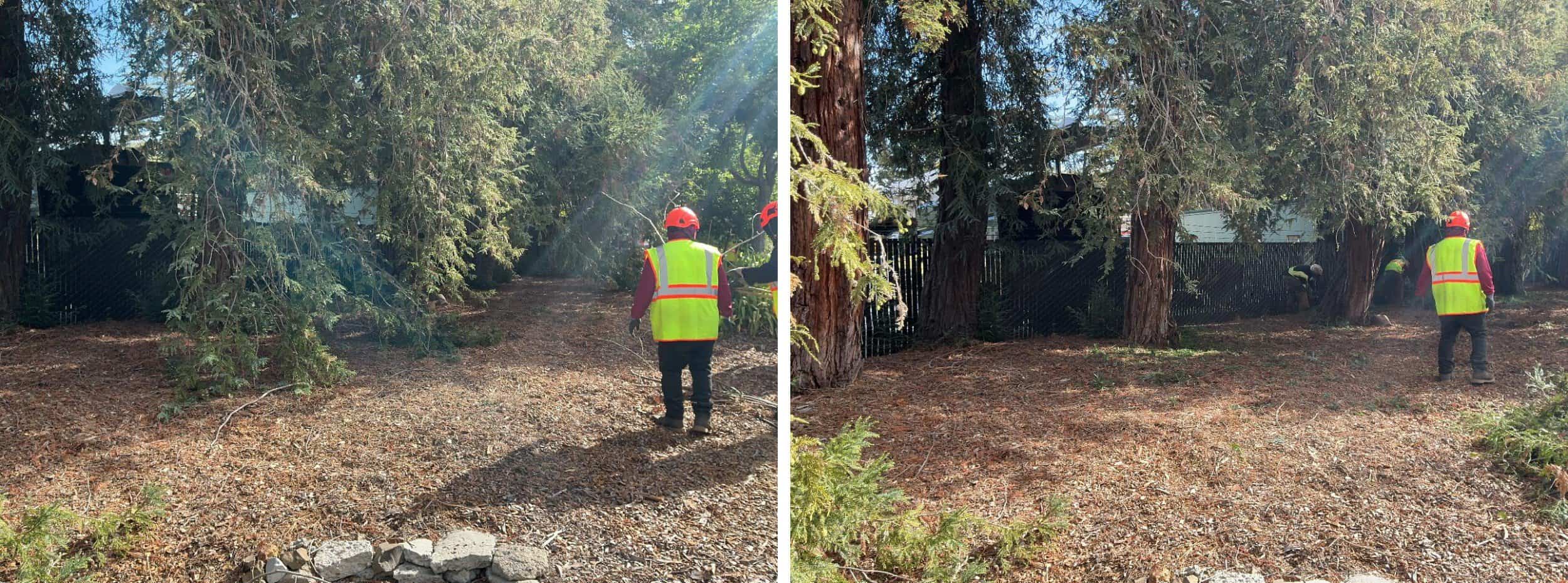
arastradero-maintenance-before-after-set-7
Low-growing tree branches and excess vegetation are cut away from the lower portion of the trees to create a separation between the tree canopy and ground fuels. Hazardous vegetation, including brush, grasses, and tree limbs, is cleared to the fence line.

Low-growing tree branches and excess vegetation are cut away from the lower portion of the trees to create a separation between the tree canopy and ground fuels. Hazardous vegetation, including brush, grasses, and tree limbs, is cleared to the fence line.

arastradero-maintenance-before-after-set-8
Hazardous vegetation, including brush, grasses, and tree limbs, is cleared to the fence line.

Hazardous vegetation, including brush, grasses, and tree limbs, is cleared to the fence line.

previous arrow
next arrow
 

Project Site

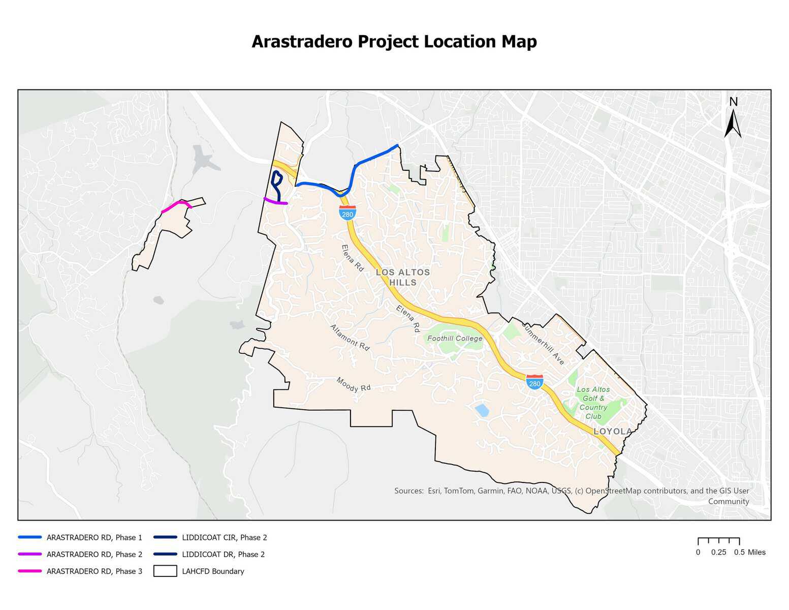
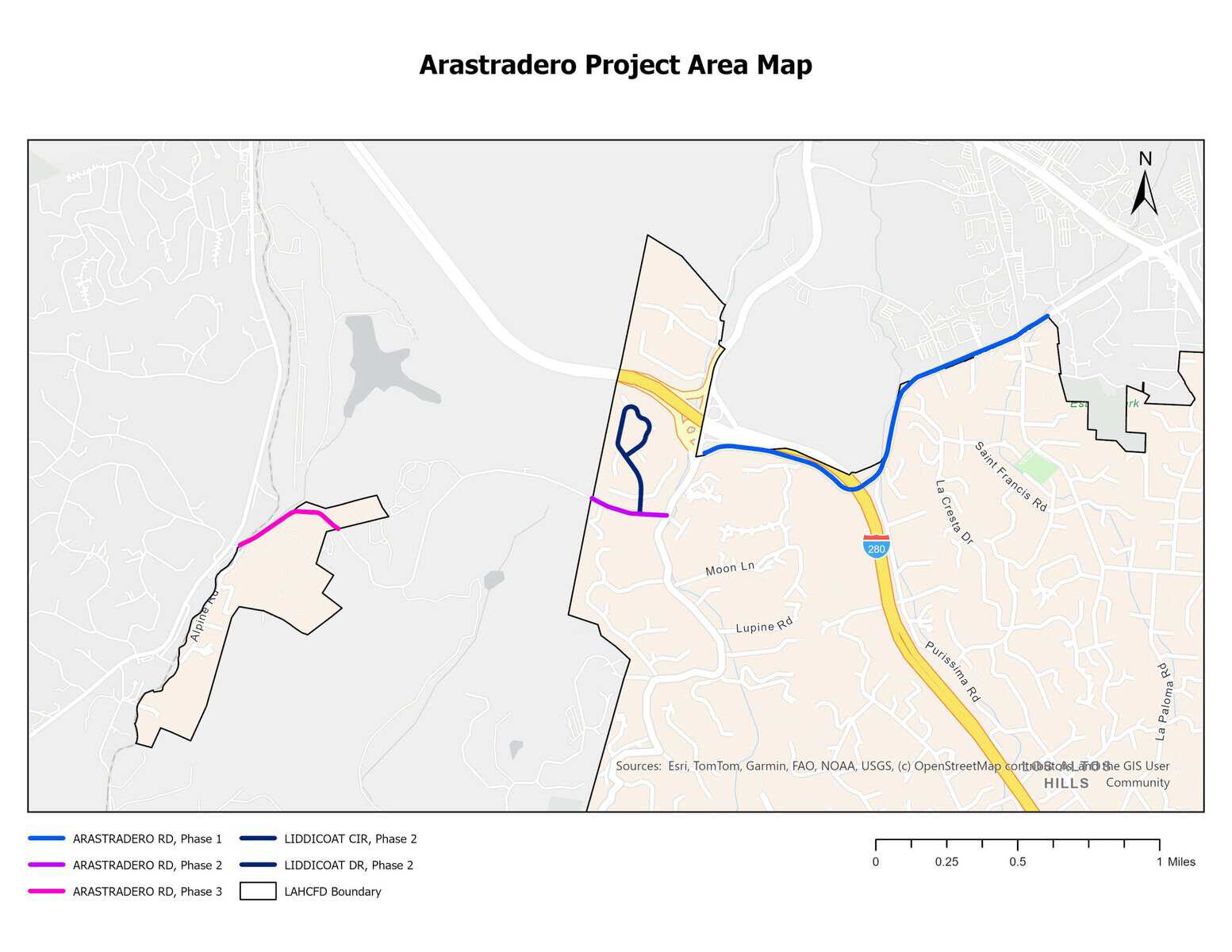
This evacuation route project intends to treat all portions of Arastradero Road within the Los Altos Hills County Fire District, including Los Altos Hills, and Portola Valley in three phases.

Phase 1:

  • Arastradero Road: From Old Adobe Road to Page Mill Road. Approximately 1.6 linear miles, 3.2 treated miles.

Phase 2:

  • Arastradero Road: From Page Mill Road to Tracy Court. Approximately 0.2 linear miles, 0.4 treated miles.
  • Liddicoat Drive: From Arastradero Road to Liddicoat Circle. Approximately 0.2 linear miles, 0.4 treated miles.
  • Liddicoat Circle: The complete loop beginning and ending at Liddicoat Drive. Approximately 0.4 linear miles, 0.8 treated miles.

Phase 3:

  • Arastradero Road: From Caballo Lane to Alpine Road. Approximately 0.4 linear miles, 0.8 treated miles.

Total treated area: approximately 2.8 linear miles, 5.6 treated miles.
Click to enlarge.
Click to enlarge.
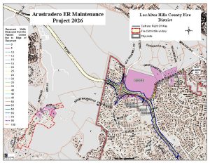
Arastradero 2026 Parcel Map

Click to enlarge.


Treatment History

This is a map of the Arastradero Road Evacuation Project site, highlighting, in blue, the route from the intersection of Arastradero Road, Page Mill Road, and the I-280 park-and-ride, continuing southeast towards Fremont Road.

Click to enlarge.

2022 December Initial Treatment

The initial treatment of Arastradero treated one (1) roadway:

  • Arastradero Road from Page Mill Road to the Los Altos Hills County Fire District boundary near the intersection of Arastradero Road and Old Adobe Road

Project length: approximately 3.92 treated miles
View Final Report

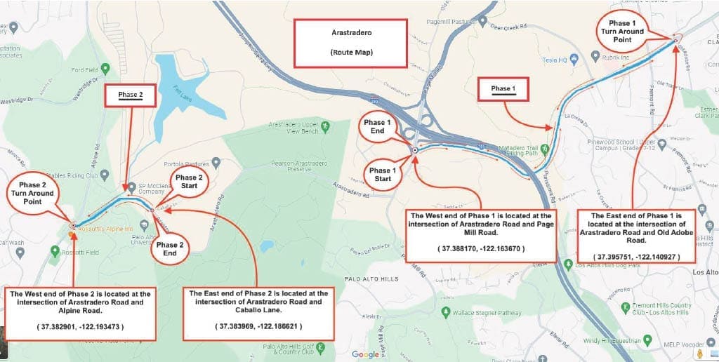
Arastradero Route Map 2024

Click to enlarge.

2024 October Maintenance Treatment

The 2024 maintenance treatment of Arastradero treated two (2) portions of the roadway in two phases:

  • Phase 1: Arastradero Road from Page Mill Road to the Los Altos Hills County Fire District boundary near the intersection of Arastradero Road and Old Adobe Road
  • Phase 2: Arastradero Road in Portola Valley from Alpine Road to the LAHCFD boundary

Project length: approximately 3.92 treated miles

View Final Report

Click to enlarge.

2026 September Maintenance Treatment

The 2026 maintenance treatment of Arastradero will add another section of Arastradero Road and two (2) tributary roads to the project scope and treat a total of three (3) roadways:

  • Phase 1: Arastradero Road from Page Mill Road to the Los Altos Hills County Fire District boundary near the intersection of Arastradero Road and Old Adobe Road
  • Phase 2: Arastradero Road from Page Mill Road to the Los Altos Hills County Fire District boundary near the intersection of Arastradero Road and Tracy Court
  • Phase 2 Tributaries: Liddicoat Drive and Liddicoat Circle
  • Phase 3: Arastradero Road in Portola Valley from Alpine Road to the LAHCFD boundary

Project length: approximately 5.6 treated miles

View Final Report

Frequently Asked Questions (FAQs)

What happens to the vegetation that Los Altos Hills County Fire District cuts down?
How will it look when the project is finished?
How does vegetation management help roadway visibility?
What is the Right of Entry (ROE)?
What is a Riparian area or zone?
What kind of preparation is done for vegetation management?
Do eucalyptus trees specifically contribute to wildfire risks?
How can we maintain eucalyptus trees to prevent wildfire?
How is traffic controlled at the project sites?
How are these projects scheduled for traffic control?
Roadside maintenance projects: how important are they?
What is the importance of an evacuation route during a wildfire?
Why is it important to focus on intersections?
How far should the vegetation be trimmed or cut?

  • Accessibility Statement
  • General & Social Media Disclaimers
  • Privacy Policy

© 2026 Los Altos Hills County Fire District · All Rights Reserved
Web Services by Watchdog Studio

X YouTube Instagram Alert SCC Nixle Fire Safe Nextdoor Watch Duty Facebook LinkedIn