Project Description
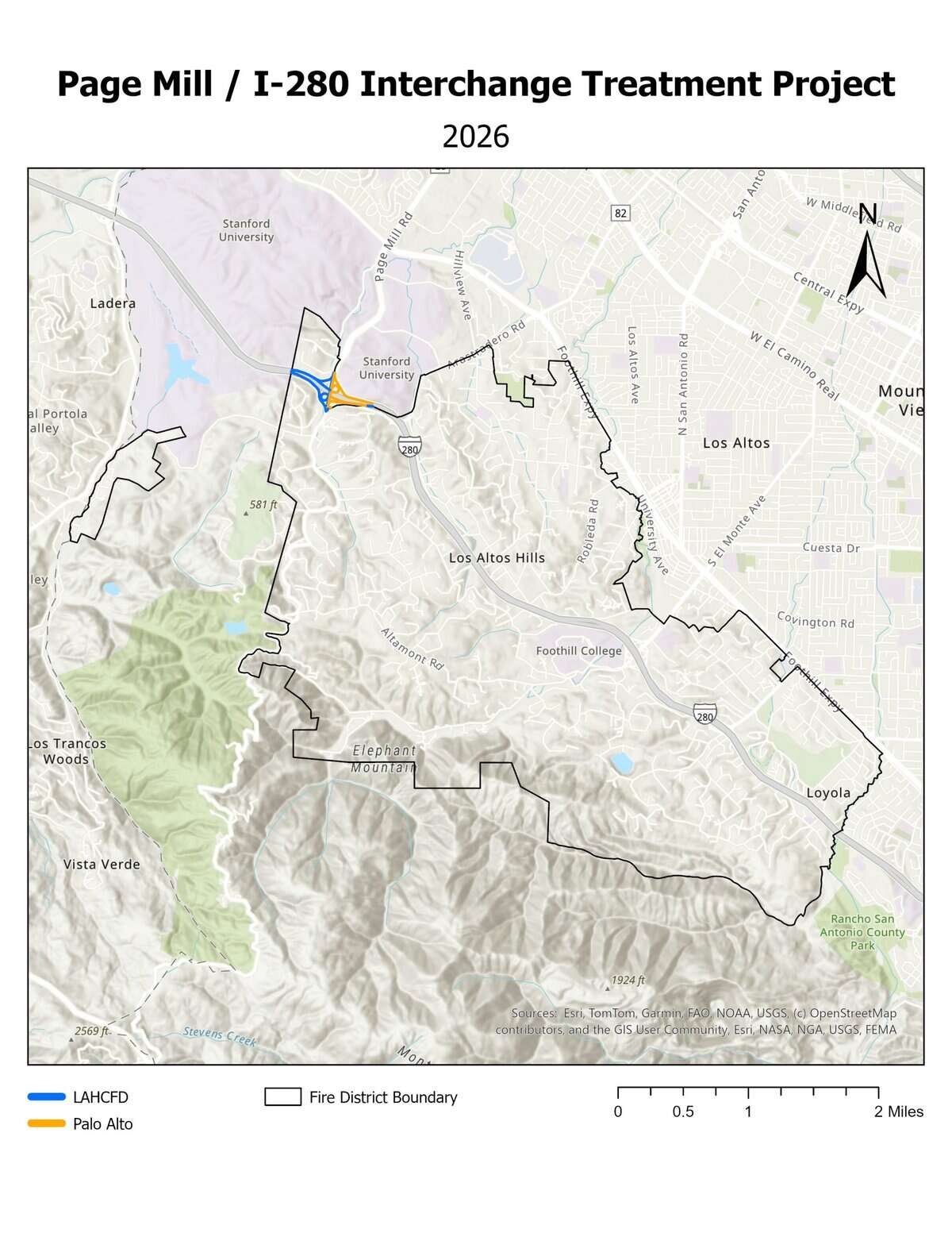
The Page Mill / I-280 Interchange in Los Altos Hills, California, provides a significant route of egress/ingress for the northern portion of the Los Altos Hills Community in the event of a fire. To secure the integrity of these egress/ingress routes and freeway access, Los Altos Hills County Fire District, City of Palo Alto, Palo Alto Fire Department, Santa Clara County Fire Department, and Santa Clara County FireSafe Council propose a roadside treatment of hazardous fuels.
Before & After Photos
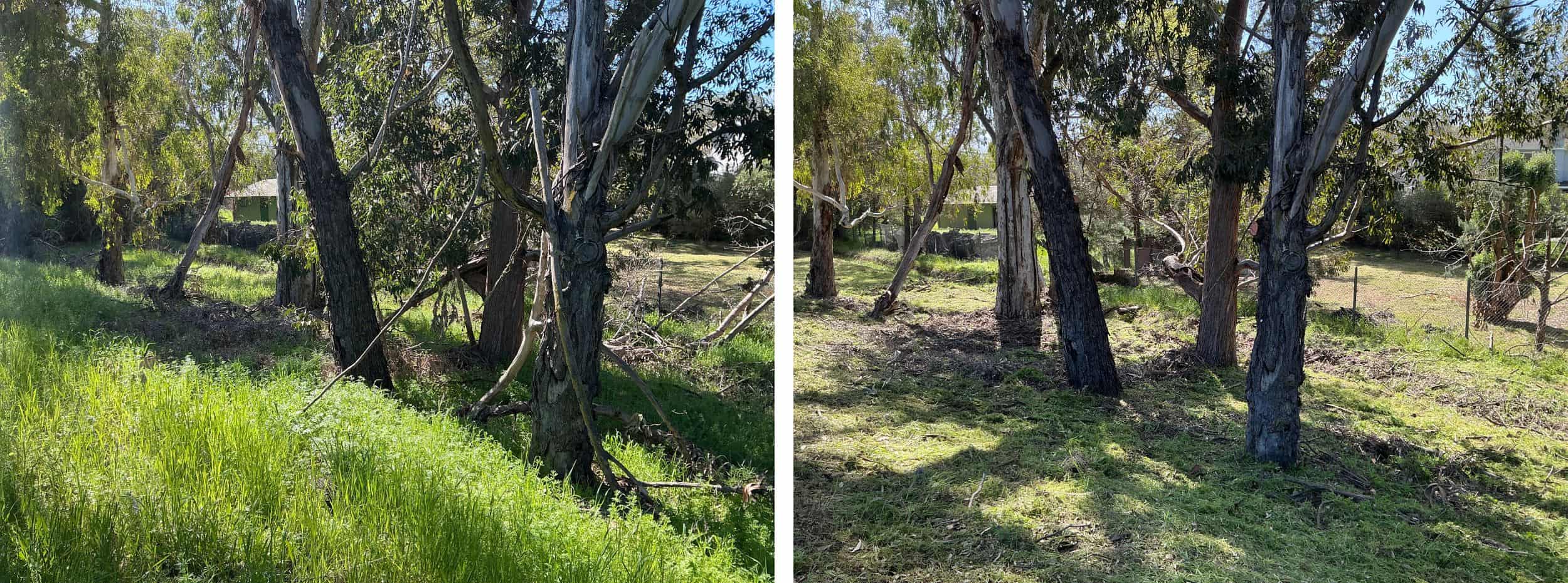
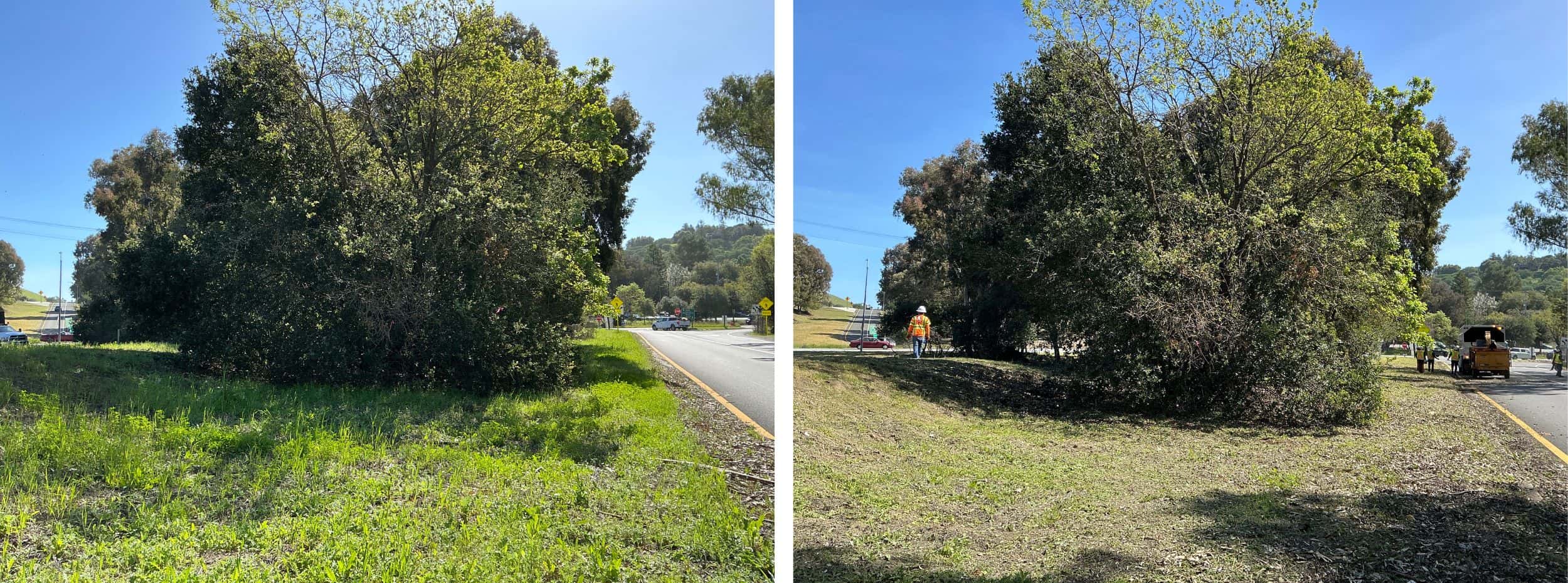
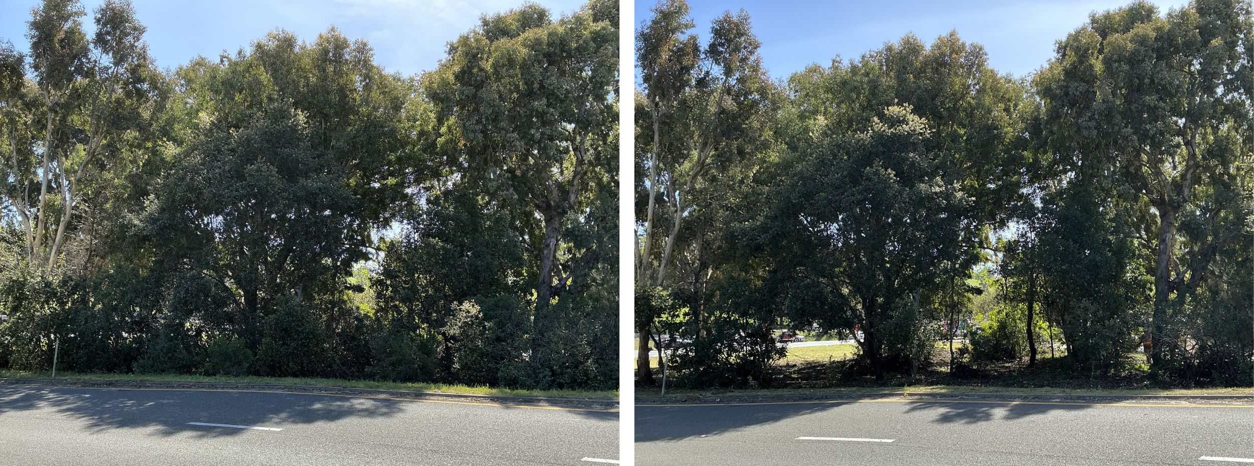
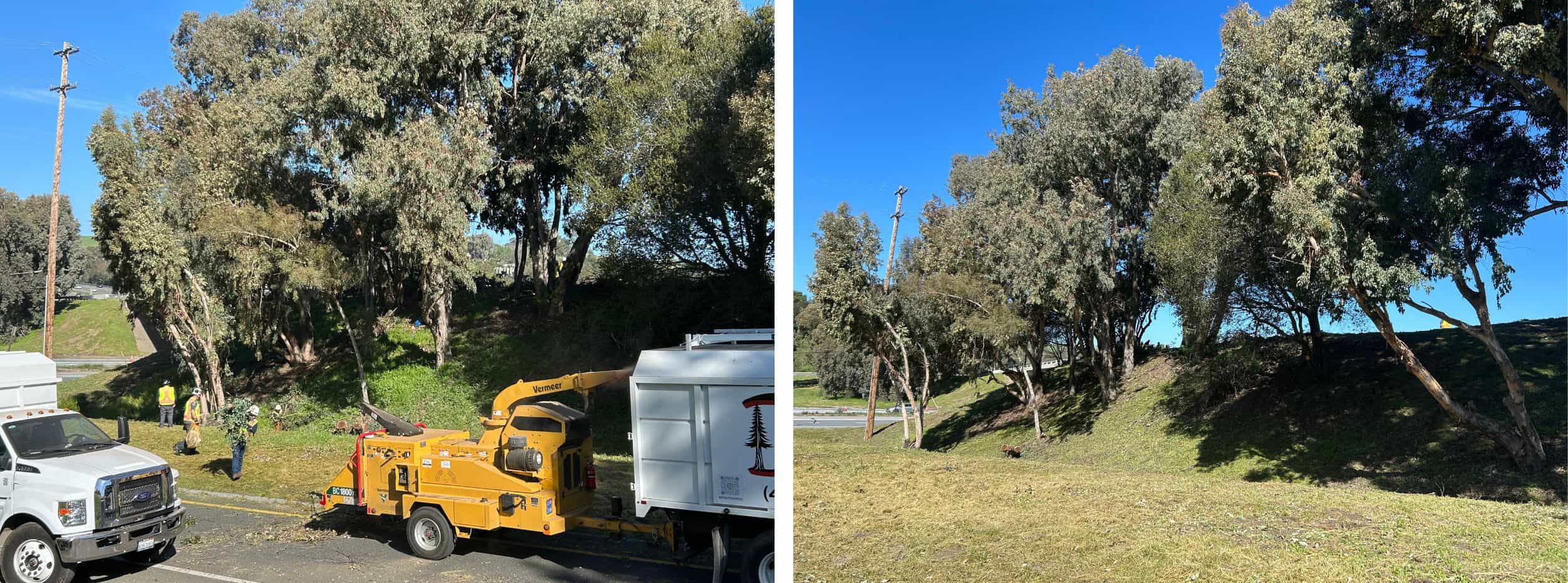
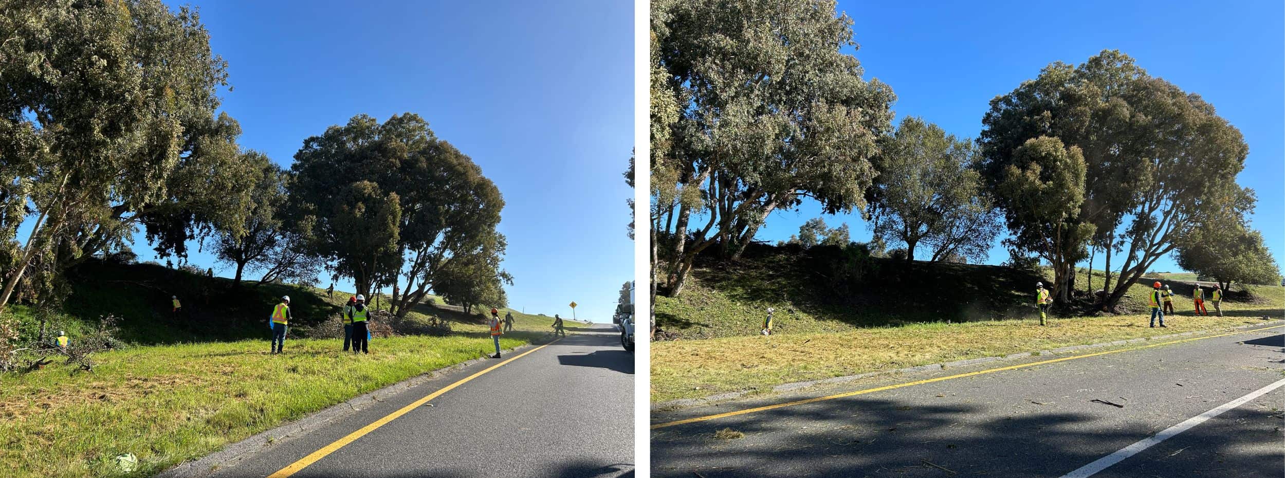
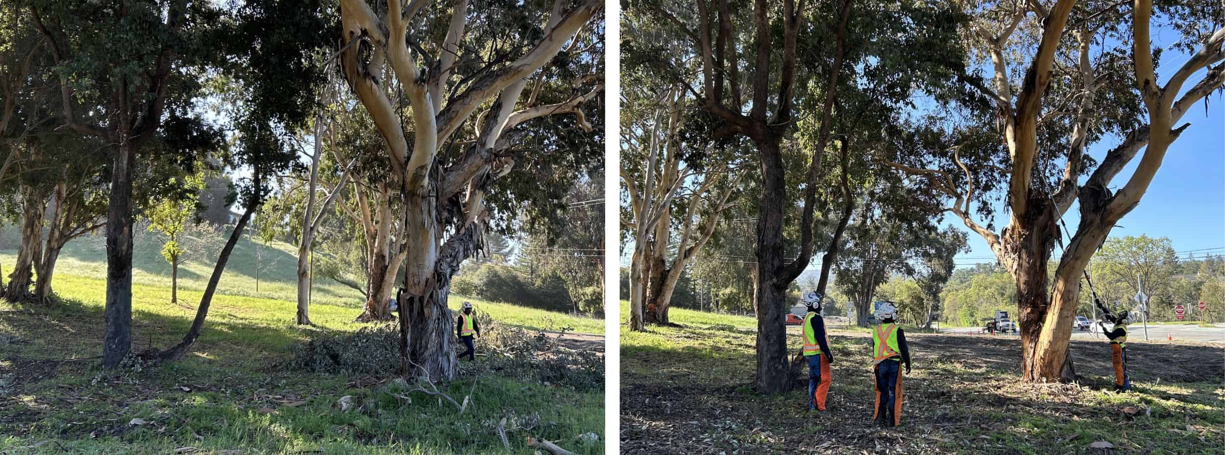
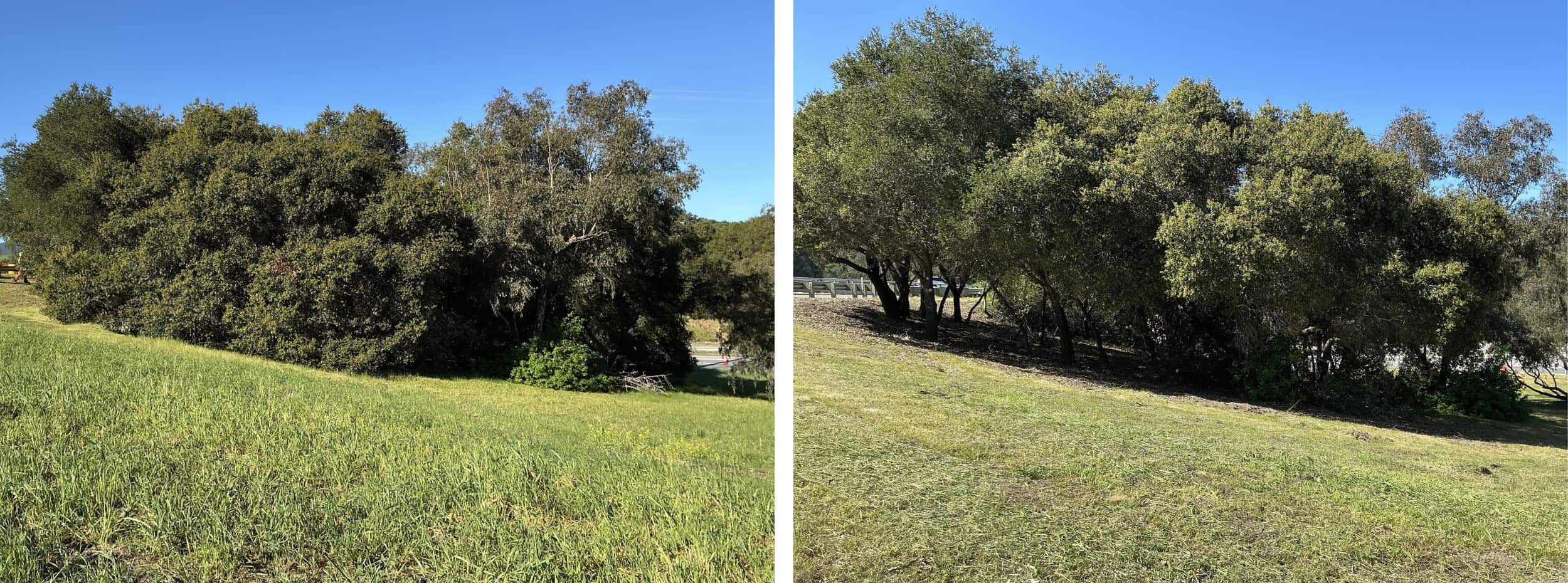
EXAMPLE 1: Low-growing tree branches and excess vegetation are cut away from the lower portion of the trees to create a separation between the tree canopy and ground fuels. Weeds, grasses and ground vegetation within the public right of way are trimmed to shorter than 6". Wooded vegetation piles will be cleaned up and chipped.


Project Site
This project treated the Page Mill / I-280 Interchange, which consists of four outer ramps and two inner loop ramps.
The following treatment areas have been separated by jurisdiction between LAHCFD and the City of Palo Alto.
The LAHCFD Jurisdiction:
These portions of the project will treat both sides of the following,
- The southbound Page Mill Road to northbound I-280 ramp, approximately 0.3 linear miles
- The southbound I-280 to Page Mill Road ramp including the left turn lane to northbound Page Mill Road, approximately 0.5 linear miles
- The on ramp to northbound I-280 from the inner loop ramp, approximately 0.2 linear miles
- The southbound Page Mill Road to southbound I-280 inner loop ramp, approximately 0.2 linear miles
- The western side and center median of southbound Page Mill Road, approximately 0.3 linear miles
- The southern ends of northbound Page Mill Road and part of the ramp onto Arastradero Road from northbound Page Mill Road, approximately 0.1 linear miles
- The southern side of the eastern end of the northbound Page Mill Road to southbound I-280 ramp, approximately 0.1 linear miles
Total treatment in LAHCFD jurisdiction: approximately 19 acres
The City of Palo Alto Jurisdiction:
These portions of the project will treat both sides of the following,
- The northbound I-280 to Page Mill Road ramp including the left turn lane to southbound Page Mill Road, approximately 0.4 linear miles
- The northbound Page Mill Road to northbound I-280 inner loop ramp, approximately 0.2 linear miles
- The northbound Page Mill Road to southbound I-280 ramp, approximately 0.2 linear miles
- The on ramp to southbound I-280 from the inner loop ramp, approximately 0.3 linear miles
- Part of the ramp onto Arastradero Road from northbound Page Mill Road and from the southbound I-280 off ramp, approximately 0.1 linear miles
- The eastern side of most of northbound Page Mill Road, approximately 0.3 linear miles
Total treatment in Palo Alto jurisdiction: approximately 16 acres
Total Project Area: approximately 35 acres or 5.86 treated miles
Click to enlarge.

Click to enlarge.
Treatment History
Click to enlarge.
2025 March Initial Treatment
Initial treatment of the Page Mill / I-280 Interchange treated four outer ramps and two inner loop ramps.
- North-western and south-western quadrants within the Los Altos Hills County Fire District boundary
- North-eastern and south-eastern quadrants within the Palo Alto boundary
Project area: approximately 35 acres or 5.86 treated miles
Maintenance treatment was completed March 13, 2026. Final Report Coming Soon.