Project Description
The Black Mountain-Purissima Road Evacuation Route Project in Los Altos Hills, California, provides an important egress route for a significant portion of the western area of the Los Altos Hills community in the event of an evacuation, such as during a wildfire. To secure the integrity of this route, Los Altos Hills County Fire District and Santa Clara County FireSafe Council propose roadside treatment of hazardous fuels.
Read the Black-Purissima media release.
Before & After Photos

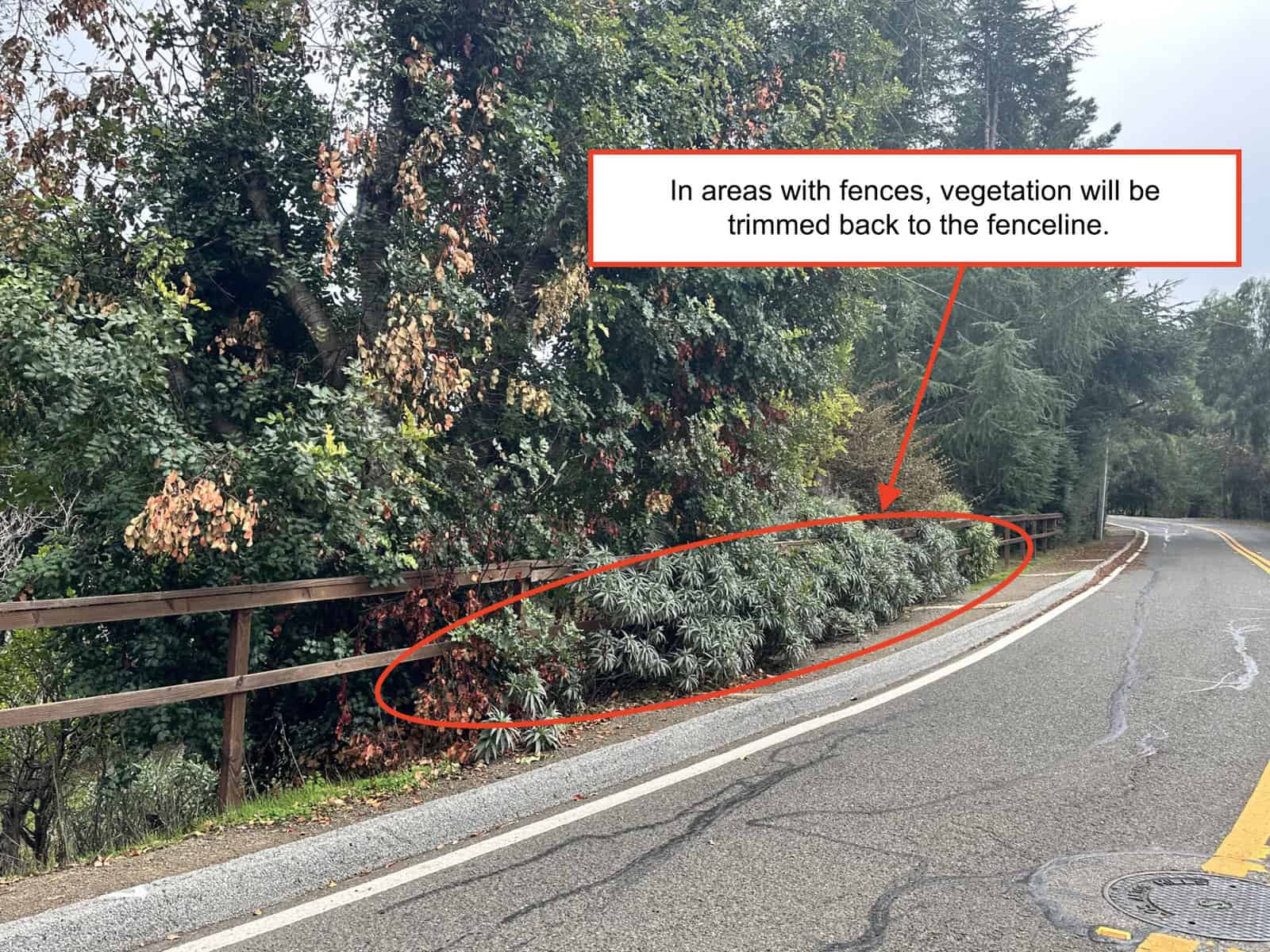
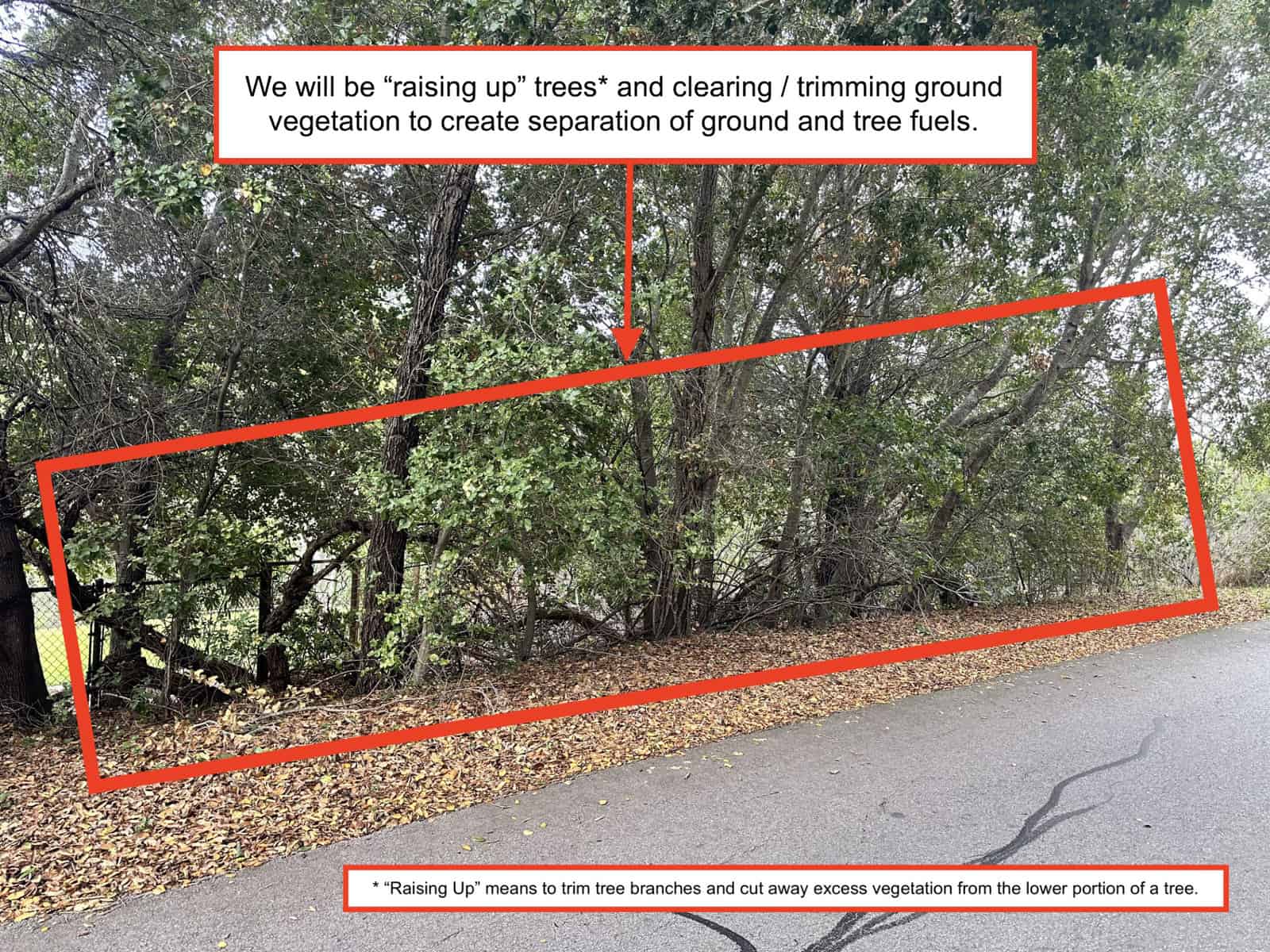
In areas with fences, vegetation has been trimmed back to the fence line. Low-growing tree branches and excess vegetation are cut away from the lower portion of the trees to create a separation between the tree canopy and ground fuels.


Treatment
Click any image below to enlarge it.

![]()


Project Site

Click to enlarge.
This evacuation route project will treat four roads along the route. These include Black Mountain Road, Natoma Road, Elena Road, and Purissima Road.
The southwestern end of the project is located at the intersection of Black Mountain Road and Altamont Road (37.366180, -122.158790) and the northeastern end of the project is located at the intersection of Purissima Road and Arastradero Road (37.386986, -122.152411).
The length of the project is approximate:
- The Black Mountain Road portion is 0.5 linear miles, which equates to 1 mile when accounting for treatment on both sides of the road.
- The Natoma Road portion is 0.6 linear miles, which equates to 1.2 miles when accounting for treatment on both sides of the road.
- The Elena Road portion is 0.6 linear miles, which equates to 1.2 mile when accounting for treatment on both sides of the road.
- The Purissima Road portion is 0.4 linear miles, which equates to 0.8 miles when accounting for treatment on both sides of the road.
- The total treatment of the project is approximately 4.2 miles in length which equates to 8.4 miles of treatment when accounting for both sides of the route.
Schedule
This project started on March 18, 2024 and was completed March 21, 2024.