Project Description
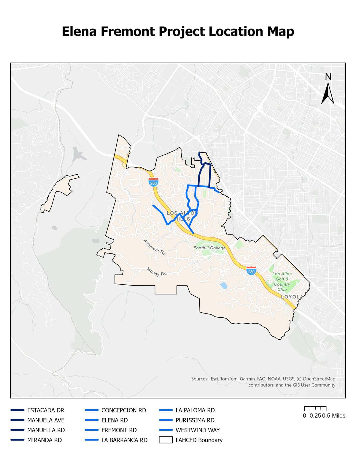
Elena-Fremont evacuation routes in Los Altos Hills, California provide a significant route of egress/ingress for the northern portion of the Los Altos Hills community in the event of a wildfire. To secure the integrity of these egress/ingress routes, Los Altos Hills County Fire District and Santa Clara County FireSafe Council propose a roadside treatment of hazardous fuels.
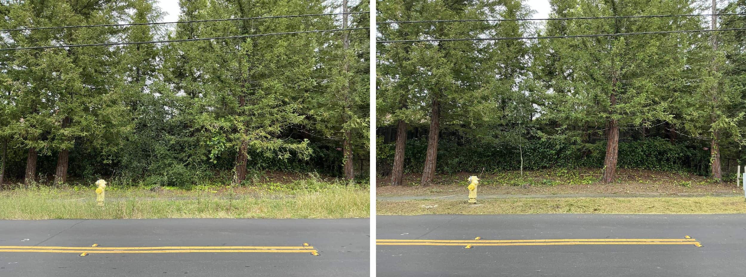
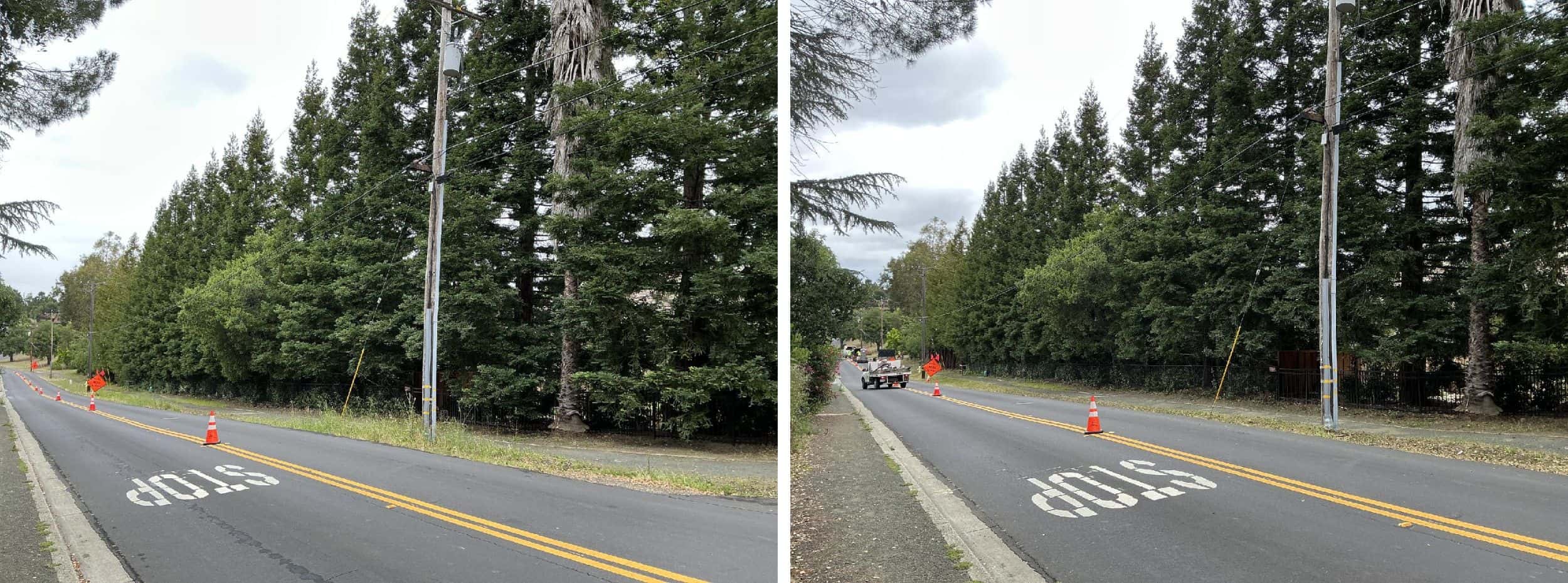
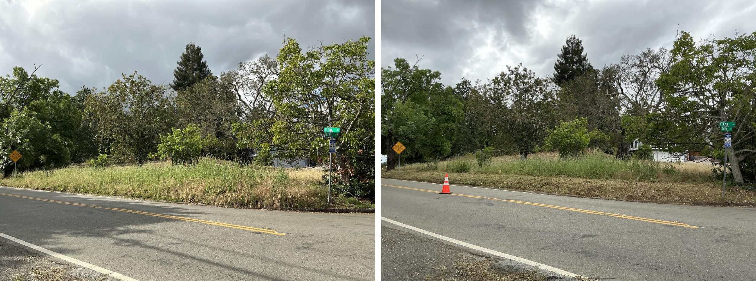
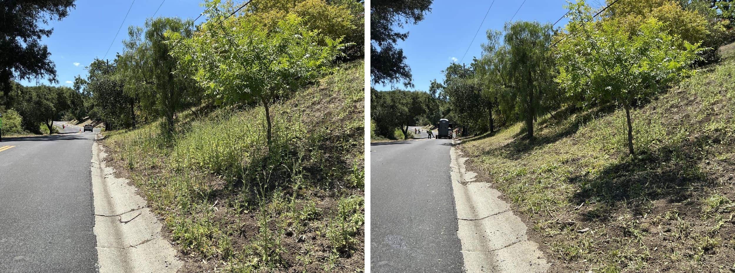
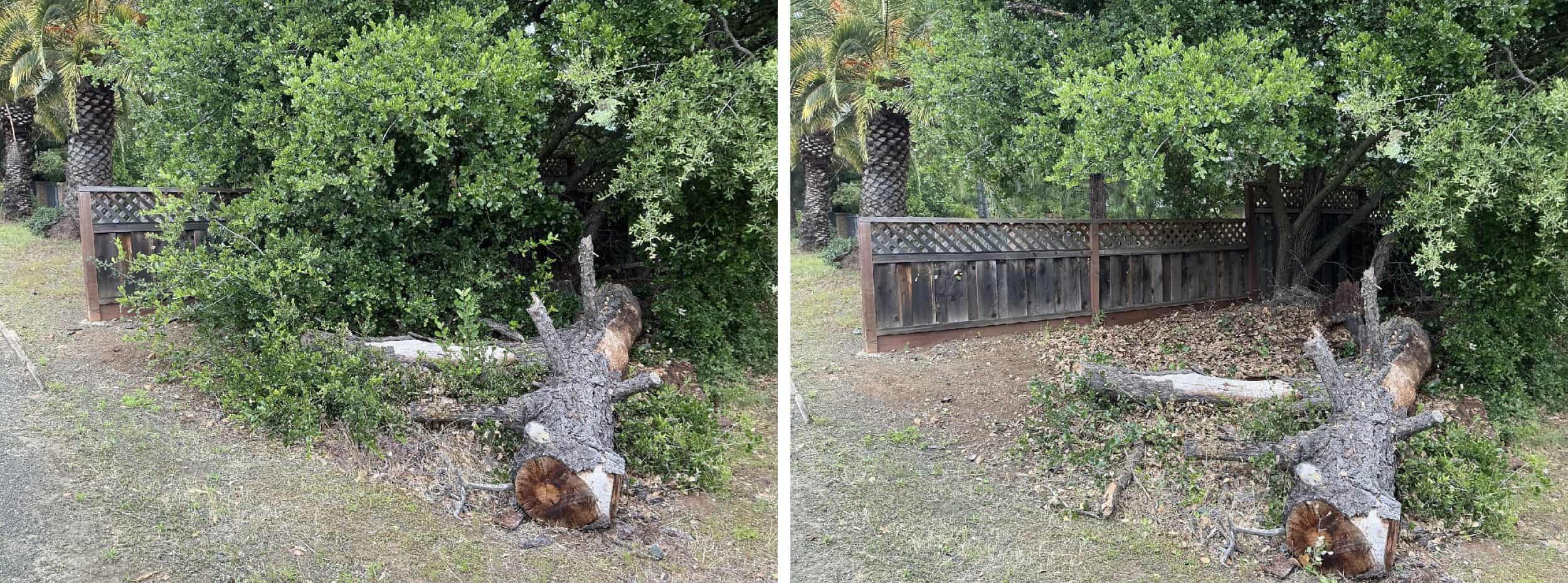
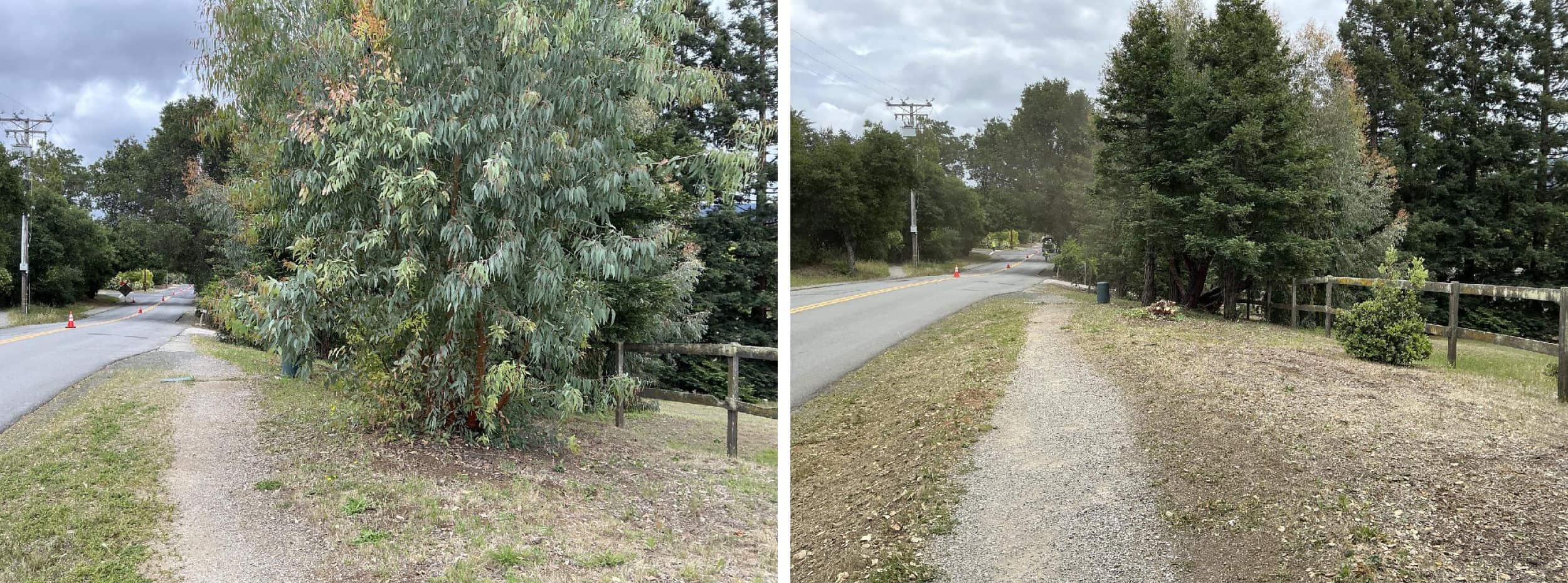
Before & After Photos
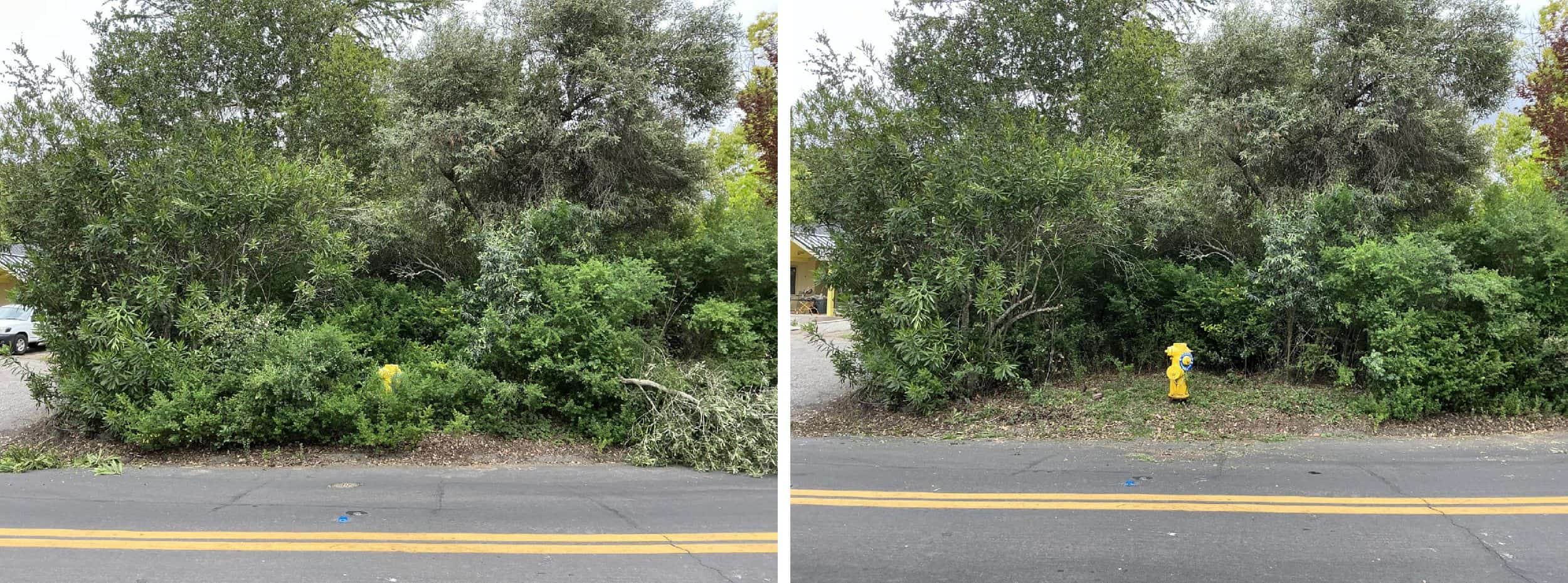
EXAMPLE 1: Vegetation will be cleared within a 3 foot bubble around fire hydrants to allow for proper identification and use of these assets by emergency service personnel.
Project Site
The 2026 project treated eleven (11) roads along the evacuation route.
- Elena Road from Natoma Road to La Barranca Road. Approximately 0.6 linear miles, 1.2 treated miles.
- La Barranca Road from Elena to Purissima Road. Approximately 0.4 linear miles, 0.8 treated miles.
- Purissima Road from La Barranca to Robleda Road. Approximately 0.5 linear miles, 1 treated mile.
- Concepcion Road from Purissima to W. Fremont Road. Approximately 0.9 linear miles, 1.8 treated miles.
- W. Fremont Road from Concepcion Road to W. Edith Avenue. Approximately 0.8 linear miles, 1.6 treated miles.
- Westwind Way from Concepcion Road to La Paloma Road. Approximately 0.2 linear miles, 0.4 treated miles.
- La Paloma Road from Purissima Road to W Fremont Road. Approximately 1 linear mile, 2 treated miles.
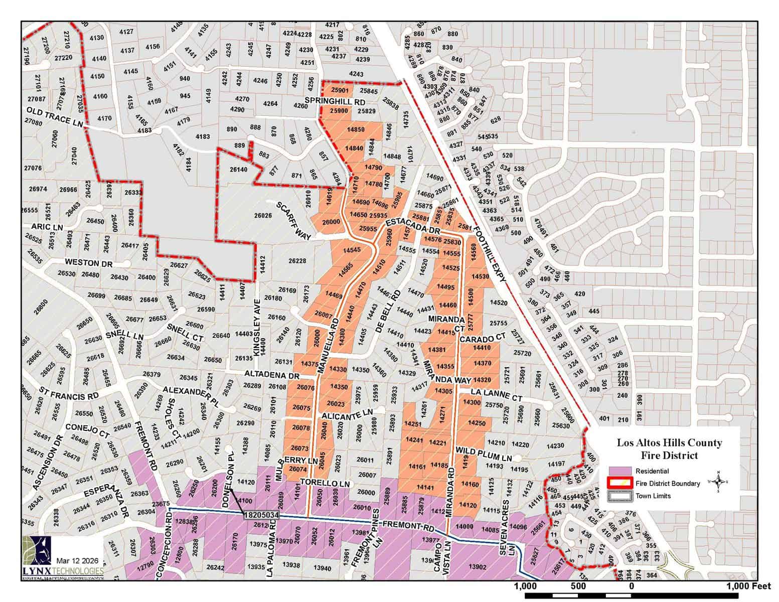
- Manuella Road from W Fremont Road to Springhill Drive (37.3932481, -122.1331162). Approximately 0.8 linear miles, 1.5 linear miles.
- Manuella Avenue from Springhill Drive to the Los Altos Hills County Fire District Boundary. Approximately 0.03 linear miles, 0.03 treated miles.
- Estacada Drive: From Manuella Road to Miranda Road. Approximately 0.2 linear miles, 0.4 treated miles.
- Miranda Road: From Estacada Drive to W Fremont Road. Approximately 0.5 linear miles, 1 treated mile.
The West end of the project is located at the intersection of Elena and Natoma Road (37.3756413, -122.1521703) and the East end of the project is located at the intersection of W Fremont Road and W Edith Avenue (37.3804304, -122.1245742).
Total treated area: approximately 5.9 linear miles, 11.7 treated miles.
Parcel maps below highlight residences (parcels) adjacent to the three segments of the project route.
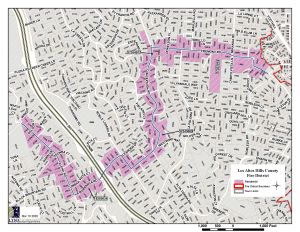
Click to enlarge.

Click to enlarge.
Click to enlarge.
Treatment History

Click to enlarge.
2024 March Initial Treatment of Elena Fremont
The initial treatment of Elena – Fremont treated five (5) roadways:
- Elena Road from Wright Way to La Barranca Road
- La Barranca Road from Elena Road to Purissima Road
- Purissima Road from La Barranca Road to Concepcion Road
- Concepcion Road from Purissima Road to Fremont Road
- Fremont Road from Concepcion Road to W. Edith Avenue
Project length: approximately 5.47 treated miles

Click to enlarge.
2024 June Initial Treatment of La Paloma
The initial treatment of La Paloma treated three (3) roadways:
- Purissima Road from Concepcion Road to Robleda Road
- La Paloma Road from Purissima Road to Fremont Road
- Westwind Way from Concepcion Road to La Paloma Road
Project length: approximately 3.2 treated miles
View 2024 La Paloma Final Report
Click to enlarge.
2026 May Maintenance Treatment of Elena-Fremont
The maintenance treatment of Elena – Fremont combined Elena – Fremont and La Paloma, added four (4) tributary roads to the project scope, and treated a total of eleven (11) roadways:
- Elena Road from Wright Way to La Barranca Road
- La Barranca Road from Elena Road to Purissima Road
- Purissima Road from La Barranca Road to Robleda Road
- Concepcion Road from Purissima Road to Fremont Road
- Fremont Road from Concepcion Road to W. Edith Avenue
- La Paloma Road from Purissima Road to Fremont Road
- Westwind Way from Concepcion Road to La Paloma Road
- Manuella Road from Fremont Road to Springhill Drive
- Manuella Avenue from Springhill Drive to the Los Altos Hills County Fire District Boundary
- Estacada Drive from Manuella Road to Miranda Road
- Miranda Road from Estacada Drive to Fremont Road
Project length: approximately 11.7 treated miles
Maintenance treatment was completed May 13th. Final Report Coming Soon.