Project Description
The Altamont evacuation route in Los Altos Hills, California provides a significant route of egress/ingress for the northern portion of the Los Altos Hills community in the event of a fire. To secure the integrity of this egress/ingress route, Los Altos Hills County Fire District and Santa Clara County FireSafe Council propose a roadside treatment of hazardous fuels.
You may read more about Altamont project goals on the Santa Clara County FireSafe Council website.
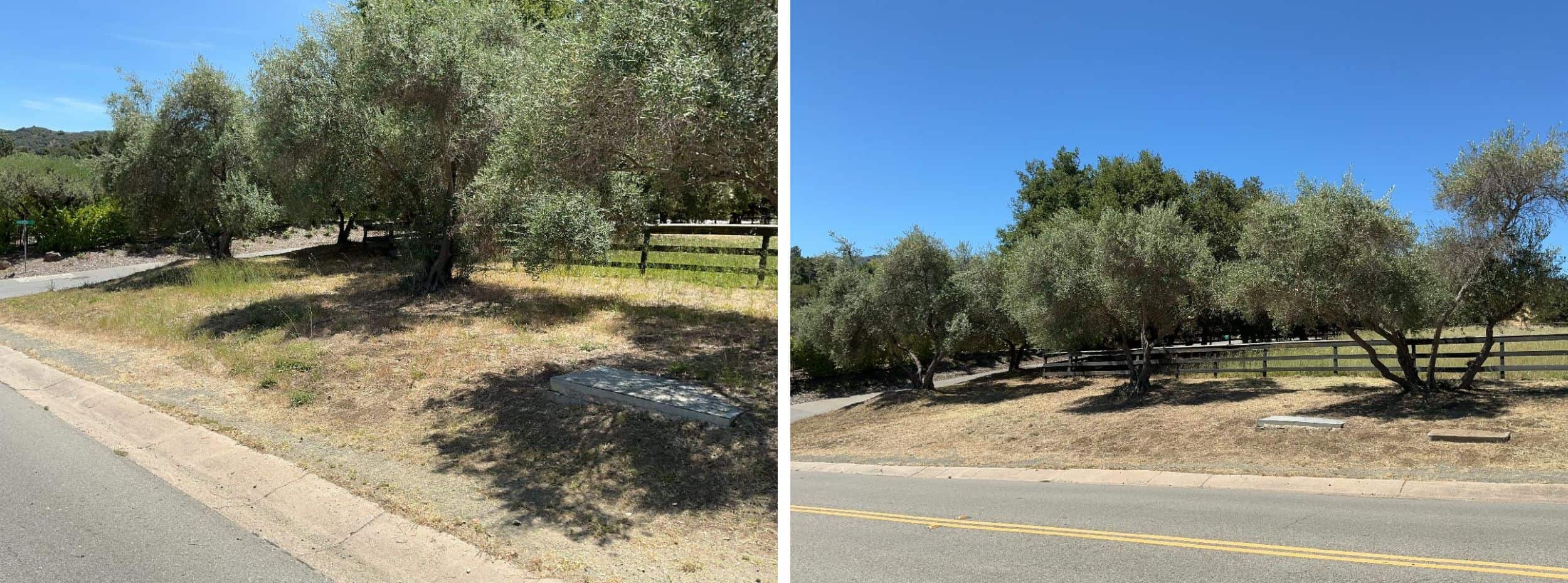
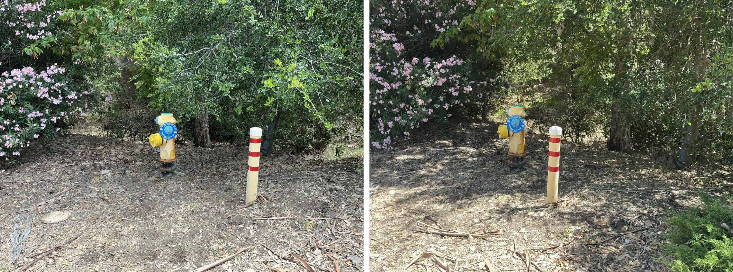
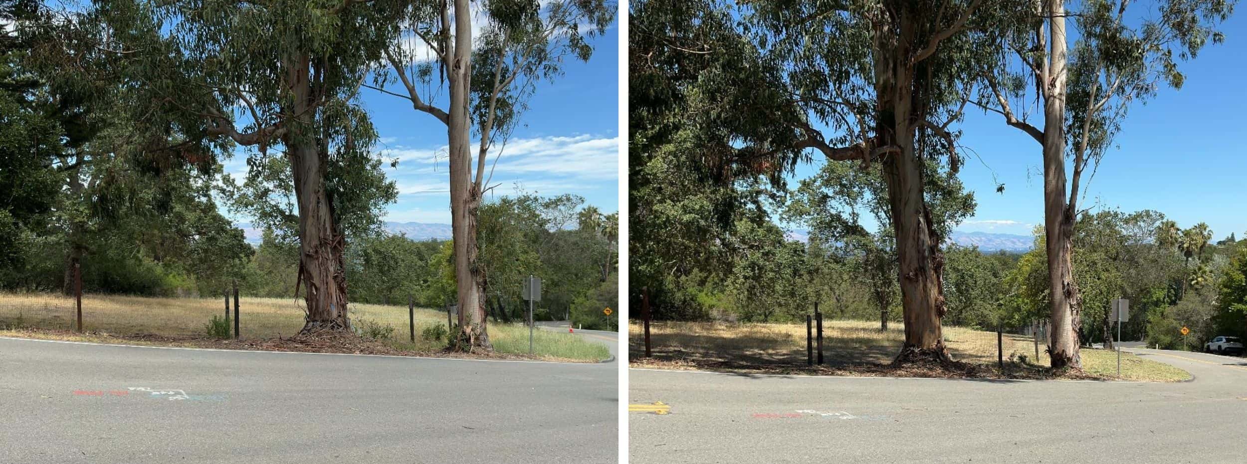
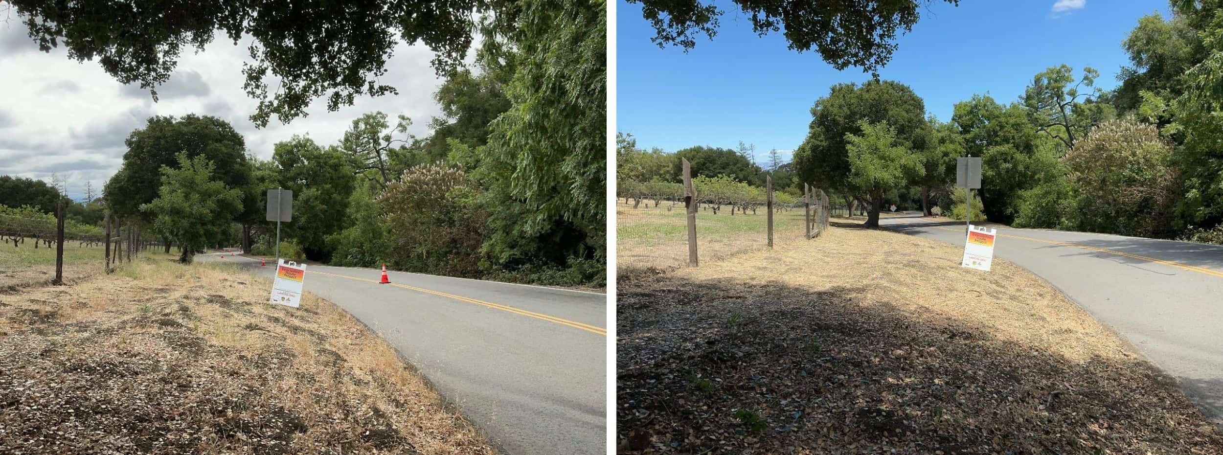
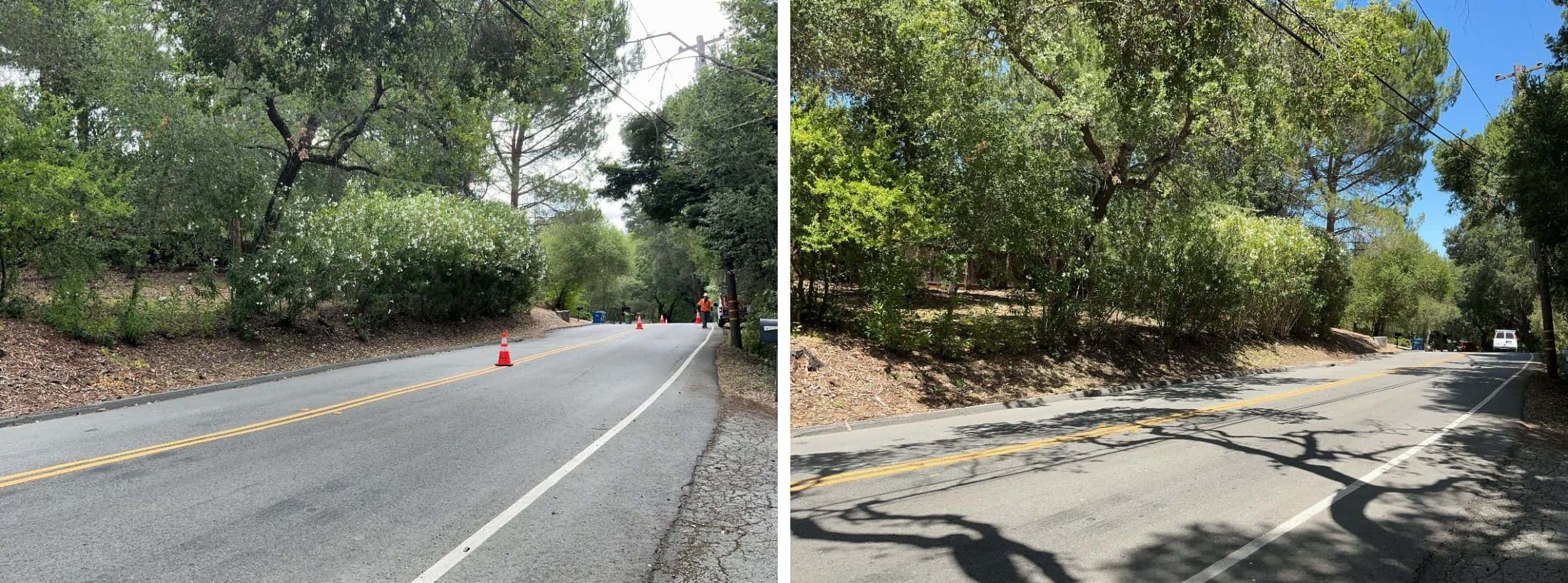
Before & After Photos
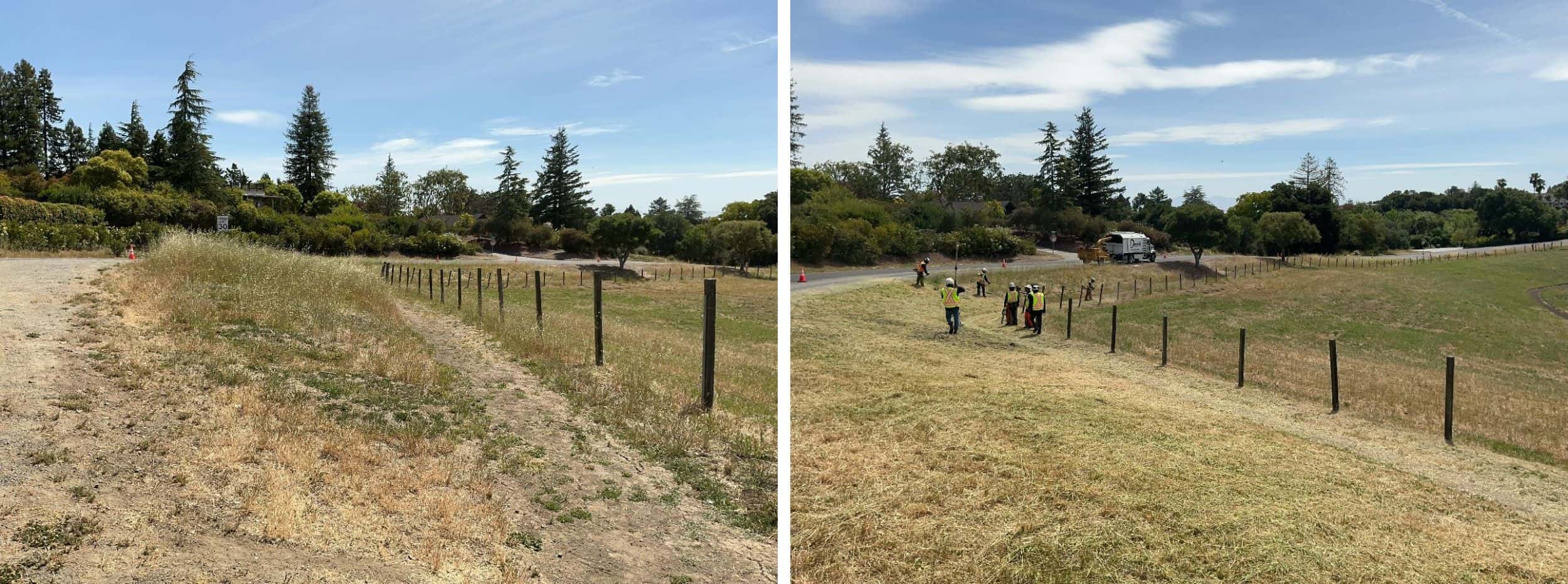
EXAMPLE 1: Weeds, grasses and ground vegetation within the public right of way are trimmed to shorter than 6". When there's a path, as shown here, the easement allows for trimming and additional 1 foot on each side of the path.
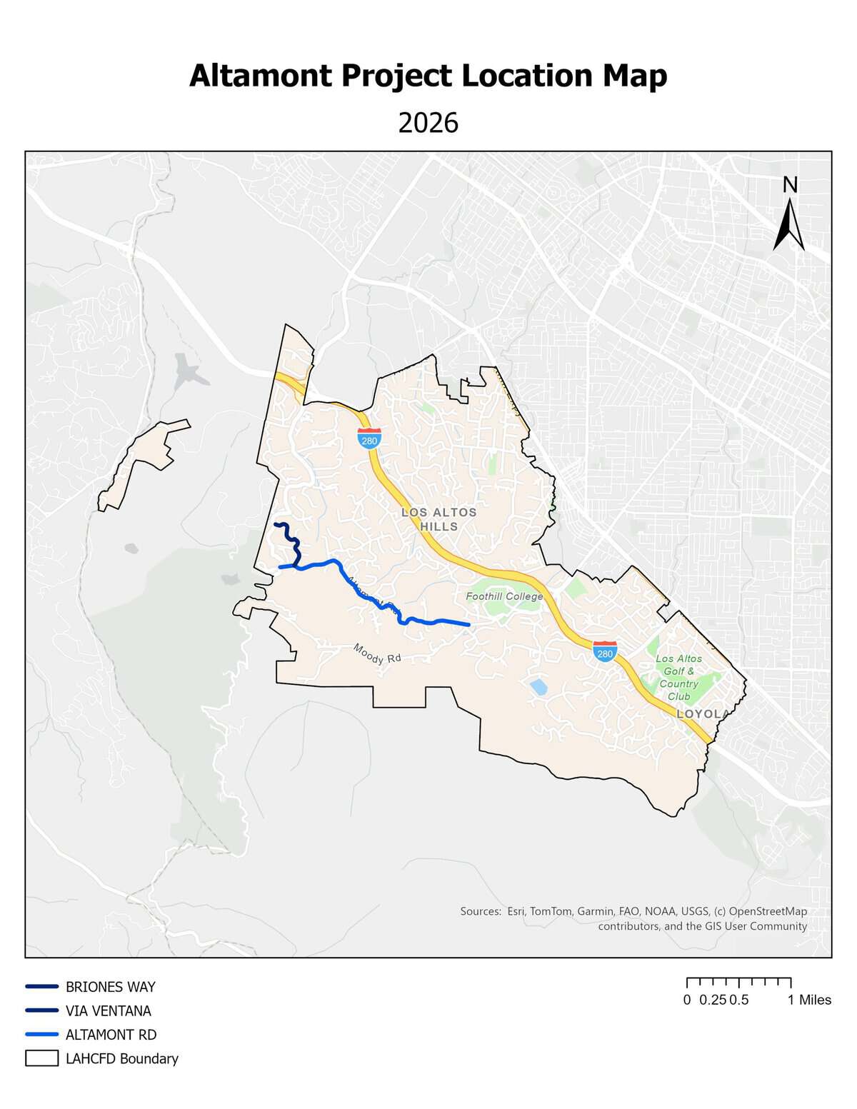
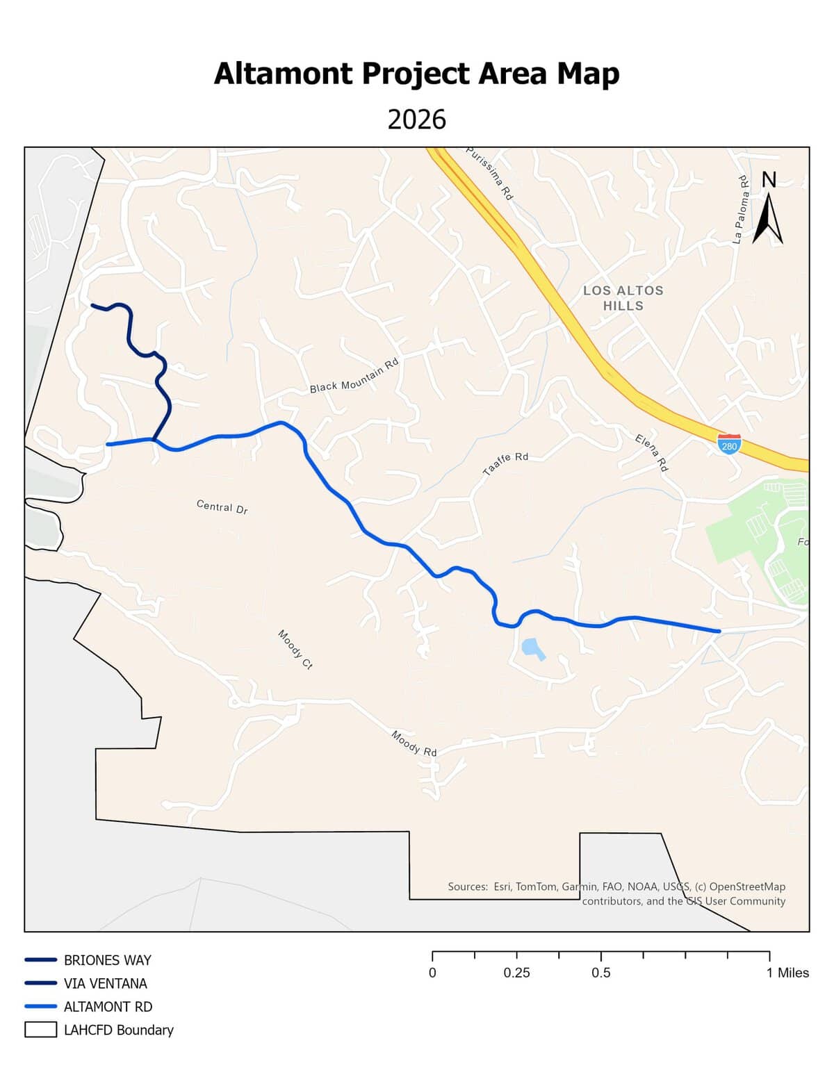
Project Site
The 2026 project treated three (3) roads along the evacuation route.
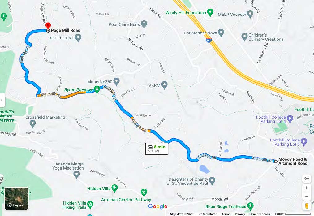
- Altamont Road: from Page Mill Road to Moody Road. Approximately 2.2 linear miles, 4.4 treated miles.
- Briones Way: From Altamont Road to Via Ventana Way. Approximately 0.3 linear miles, 0.6 treated miles.
- Via Ventana Way: From Briones Way to Page Mill Road. Approximately 0.3 linear miles, 0.6 treated miles.
The West end of the project is located at the intersection of Altamont and Page Mill Road (37.3652715, -122.1673945) and the East end of the project is located at the intersection of Altamont and Moody Road (37.3576996, -122.1342681).
Total treated area: approximately 2.8 linear miles, 5.6 treated miles.
Click to enlarge.
Click to enlarge.
Treatment History
Click to enlarge.
2022 May Initial Treatment
The initial treatment of Altamont treated one (1) roadway:
- Altamont Road from Page Mill Road to Moody Road
Project length: approximately 4.4 treated miles

Click to enlarge.
2024 September Maintenance Treatment
The 2024 maintenance treatment of Altamont treated one (1) roadway:
- Altamont Road from Page Mill Road to Moody Road
Project length: approximately 4.4 treated miles.
Click to enlarge.
2026 June Maintenance Treatment
The 2026 maintenance treatment of Altamont added two (2) tributary roads to the project scope and treated a total of three (3) roadways:
- Altamont Road from Page Mill Road to Moody Road
- Briones Way from Altamont Road to Via Ventana Way
- Via Ventana Way from Briones Way to Page Mill Road
Project length: approximately 5.6 treated miles.
Treatment completed June 12, 2026. Final Report Coming Soon.
