Project Description
The Black Mountain-Purissima Road Evacuation Route Maintenance Project in Los Altos Hills, California, provides an important egress route for a significant portion of the western area of the Los Altos Hills community in the event of an evacuation, such as during a wildfire. To secure the integrity of this route, Los Altos Hills County Fire District and Santa Clara County FireSafe Council propose roadside treatment of hazardous fuels.
Before & After Photos

Low-growing tree branches and excess vegetation are cut away from the lower portion of the trees to create a separation between the tree canopy and ground fuels.


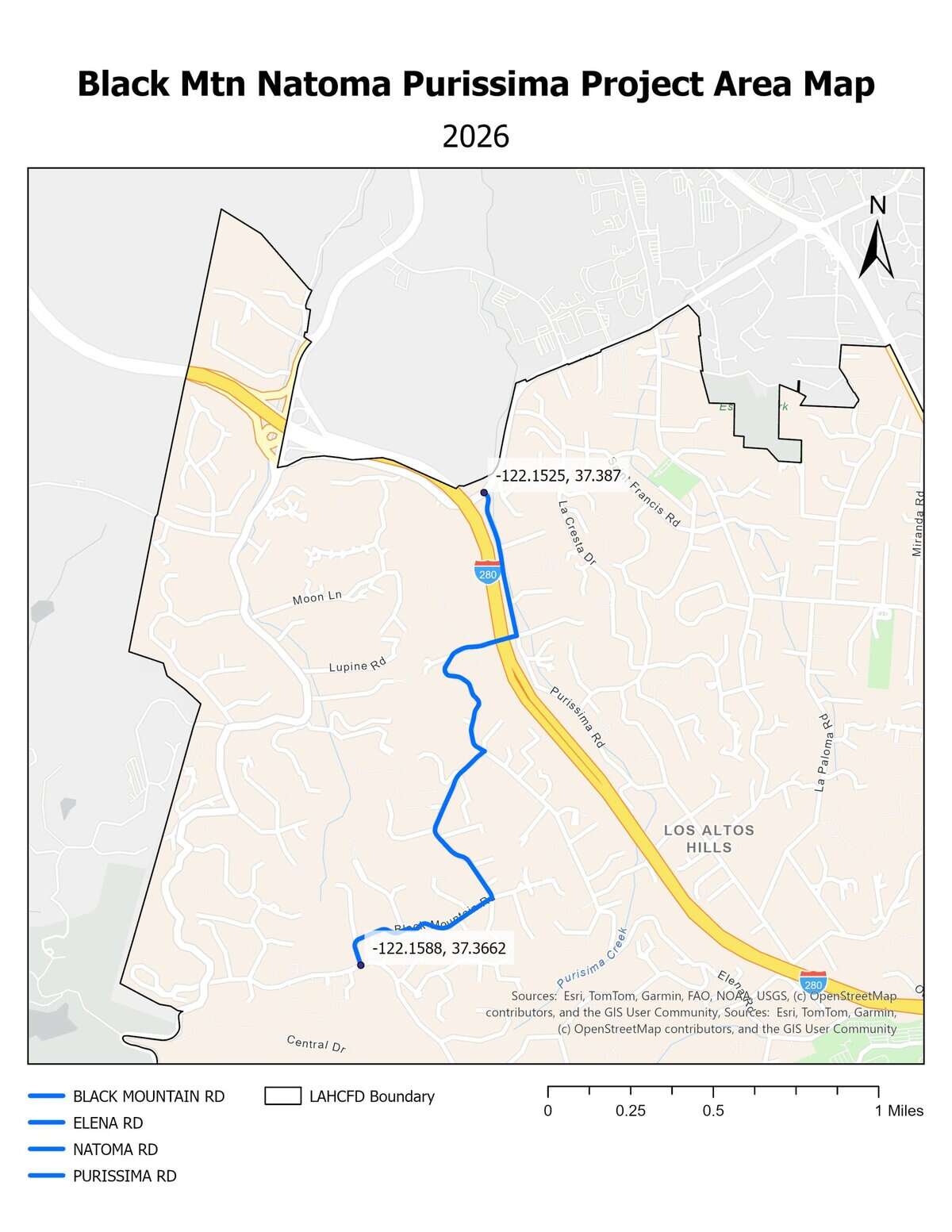
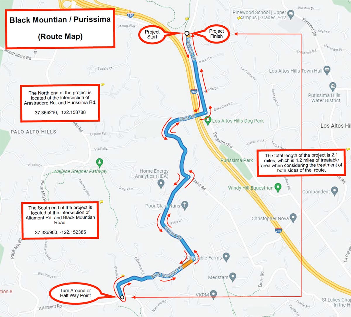
Project Site
The 2026 evacuation route project treated four (4) roads along the route.
- Purissima Road: from Arastradero Road to Elena Road. Approximately 0.5 linear miles, 1 treated mile.
- Elena Road: from Purissima Road to Natoma Road. Approximately 0.6 linear miles, 1.2 treated miles.
- Natoma Road: from Elena Road to Black Mountain Road. Approximately 0.6 linear miles, 1.2 treated miles.
- Black Mountain Road: from Natoma Road to Altamont Road. Approximately 0.5 linear miles, 1 treated mile.
The southwestern end of the project is located at the intersection of Black Mountain Road and Altamont Road (37.366180, -122.158790) and the northeastern end of the project is located at the intersection of Purissima Road and Arastradero Road (37.386986, -122.152411).
Total treated area: approximately 2.2 miles, 4.4 treated miles.
Click to enlarge.
Click to enlarge.
Treatment History
Click to enlarge.
2024 March Initial Treatment
The initial treatment of Black Mountain – Purissima treated four (4) roadways:
- Purissima Road from Arastradero Road to Elena Road
- Elena Road from Purissima Road to Natoma Road
- Natoma Road from Elena Road to Black Mountain Road
- Black Mountain Road from Natoma Road to Altamont Road
Project length: approximately 4.4 treated miles
Click to enlarge.
2026 April Maintenance Treatment
The maintenance treatment of Black Mountain – Purissima treated four (4) roadways:
- Purissima Road from Arastradero Road to Elena Road
- Elena Road from Purissima Road to Natoma Road
- Natoma Road from Elena Road to Black Mountain Road
- Black Mountain Road from Natoma Road to Altamont Road
Project length: approximately 4.4 treated miles
Maintenance treatment was completed April 9, 2026. Final Report Coming Soon.
